30 Sep La Palma eruption update 30th september 2021: Lava flows show some stability
La Palma eruption update 30th september 2021: Lava flows show some stability
Daily summary
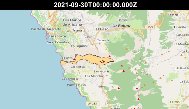
The lava delta continues to be fed by the active lava flows, which show some stability in that they are largely confined to within previous lava flows. However, there are also localised breakouts onto previously unaffected land. The lava delta has reached a thickness of 24 m and is now beginning to spread laterally. Surface activity at the main cone continues to show a mixed mechanism with strombolian activity from multiple vents in the main cone, and more effusive Hawaiian activity from a vent at the base of the NW sector on the main cone, with occasional phreatomagmatic pulses too. Throughout the morning of the 30th, an extensive fumarole field developed on the NE flank of the main cone. The continued presence of a thermal inversion is hampering the dispersal of volcanic gases and ash, leading to a decrease in air quality in the Aridane Valley. SO2 concentrations in Tazacorte peaked at ‘very high’ levels (>500 μg/m3) at 8:00 am local time and increases in SO2 concentrations have also been observed in Los Llanos de Aridane, along with reports of a ‘rotten egg’ smell, although these values do not currently represent a health hazard.
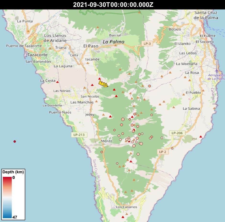
Earthquake activity continues to be concentrated near where the precursory seismic swarm began on the 11th September, as well as some earthquakes surrounding the eruptive centre. In total, 11 earthquakes were recorded, peaking at 3.5 mbLg. The ash plume height exceeds 2500 m, and the SO2 emissions are measured at 8,700 tons per day. Deformation continues to show a long-term trend of stability at all stations, and tremor also remains stable, at medium levels.

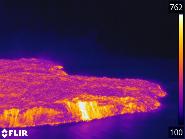
A thermal image showing the front of the lava delta, where it meets the sea. The temperature scale is in degrees Fahrenheit. Image credit: INVOLCAN
Sources: Government of the Canary Islands, PEVOLCA, Involcan, IGN, DSN, Cabildo La Palma, 112 Canarias, Tolouse VAAC
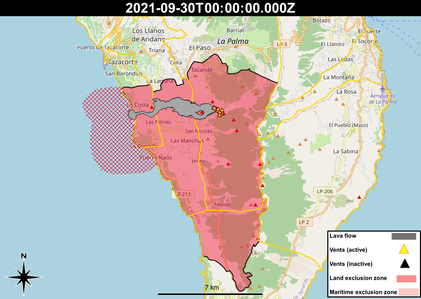
Exclusion zone map
Exclusion zones shown here have been approximated from press releases from the Cabildo de La Palma and will not be exact, nor claim to be official maps of the exclusion zones. For official information, please contact the Cabildo de La Palma.
Official social media
To see our full social media archive, visit our open data section or click here.
News articles
- The Olive Press – La Palma volcano: Animals suffer and change behavior as eruption continues – here
- Yorkshire Evening Post – The story of a leeds man who found himself in the middle of the La Palma volcano eruption – here
- Insider – PHOTOS: lava from volcanic eruption continues to obliterate homes, roads and crops on an island in Spain – here
To see our full news archive, visit our open data section or click here.
Found a broken web link? We have archived all of our news articles on the WayBack Machine. You can view the pages by 1. pasting the broken link into WayBack Machine and clicking ‘Browse History’ 2. clicking on the latest capture date and then 3. clicking ‘view capture’. Please let us know of any broken web links by contacting us at enquiries@geotenerife.com.
Eruption footage
News and Interviews
Witness Testimonies
Interactive Lava Flow Map
Notes: Use the button in the top right to open the map into full screen mode. Use the legend icon in the top left to see the legend and further information about the map. Click on individual days to see an outline of the lava flows on that day.
Interactive Earthquake Map
click here to enlarge
Notes: The size of the points represents the size of the earthquake, and the colour represents the depth. The map will also only show a certain number of points at once. For ease of use, we recommend you uncheck all dates and the satellite basemap from the legend in the top right, and inspect the earthquakes one day at a time.


Sorry, the comment form is closed at this time.