24 Oct La Palma eruption update 24th october 2021: Number of earthquakes significantly increases
La Palma eruption update 24th october 2021: Number of earthquakes significantly increases
Daily summary
The new lava flow that emerged on the afternoon of the 23rd continues to flow slowly parallel to the southern limits of the old flows and has been named stream 10 to aid its tracking. Elsewhere, the active flows are largely being fed by lava tubes and channels, although not much advance is seen on the surface at the lava fronts. Throughout the eruption, there have been a total of 9 different vents, although only four of them are currently active; three strombolian vents in the main cone, and a more effusive lava emission vent located on the NW flank of the main cone and forms a conelet. In the afternoon, multiple new lava emission centres opened both at the SE end of the eruptive fissure, and on the west flank of the main cone. Earthquake activity significantly increased, although almost all events remained recorded at intermediate (10-15 km) depth. 271 events were recorded, the most recorded in a single day since the eruption began, peaking at 4.0 mbLg.
SO2 emissions rose sharply relative to previous days, reaching values of 53,600 tons per day, although this is still an underestimated value, and the ash and gas plume reached 3200 m. The tremor increased, and reached the highest signal seen for a month. Deformation remains stable at stations closest to the eruption, although a slight regional deflation is still recorded further from the eruption, with the signal thought to be of deep origin. Regarding air quality, SO2 concentrations generally improved and none of the stations suffered exceedances of the hourly threshold (350 μg/m3), although brief high peaks were seen in Puntagorda and Los Llanos. Similarly, PM10 concentrations remained low in all stations except Los Llanos, which saw brief peaks above the daily threshold (50 μg/m3).
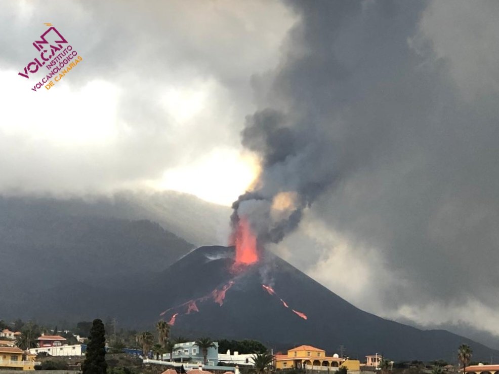
The eruption, as seen in the afternoon from the northwest, showing the generation of new streams of lava on the western flank of the volcano. Image credit: INVOLCAN
Sources: Government of the Canary Islands, PEVOLCA, Involcan, IGN, DSN, Cabildo La Palma, 112 Canarias, Tolouse VAAC, Copernicus EMS
Lava flows

Earthquakes

Exclusion zone map
Exclusion zones shown here have been approximated from press releases from the Cabildo de La Palma and will not be exact, nor claim to be official maps of the exclusion zones. For official information, please contact the Cabildo de La Palma.

Official social media
To see our full social media archive, visit our open data section or click here.
News articles
- Al Jazeera – Living through an active volcanic eruption – here
- Volcano Discovery – Quakes at La Palma are not artificial – here
To see our full news archive, visit our open data section or click here.
Found a broken web link? We have archived all of our news articles on the WayBack Machine. You can view the pages by 1. pasting the broken link into WayBack Machine and clicking ‘Browse History’ 2. clicking on the latest capture date and then 3. clicking ‘view capture’. Please let us know of any broken web links by contacting us at enquiries@geotenerife.com.
Eruption footage
News and Interviews
Witness Testimonies
Interactive Lava Flow Map
Notes: Use the button in the top right to open the map into full screen mode. Use the legend icon in the top left to see the legend and further information about the map. Click on individual days to see an outline of the lava flows on that day.
Interactive Earthquake Map
click here to enlarge
Notes: The size of the points represents the size of the earthquake, and the colour represents the depth. The map will also only show a certain number of points at once. For ease of use, we recommend you uncheck all dates and the satellite basemap from the legend in the top right, and inspect the earthquakes one day at a time.
Sorry, the comment form is closed at this time.