27 Oct La Palma eruption update 27th october 2021: Limited new land being affected by the active lava flows
La Palma eruption update 27th october 2021: Limited new land being affected by the active lava flows
Daily summary
According to PEVOLCA, the more ‘favourable’ scenario regarding the paths of lava flows remains, as they are now largely directed west of the volcano and across previous flows. This is causing a widening and thickening of the flows, but only a small amount of already isolated land is being ‘filled in’ in this new configuration. In terms of eruptive activity, the fissure eruption continues to show a mixed strombolian mechanism, with more explosive phases producing pyroclastic deposits and more effusive phases that produce lava and currently dominate. New road controls have been announced for the coming days as a result of concerns about the increasing number of tourists visiting the eruption, and the disturbances that could bring for local people and emergency personnel. Regarding seismicity, earthquakes continue at a high magnitude in the same area and depths as previous days, although at a variable frequency. 192 events were recorded, peaking at 4.8 mbLg.
The 10 cm deformation signal seen at the Jedey station closest to the eruption yesterday has almost fully reversed, whilst the rest of the network continues to show no change. SO2 emissions were slightly lower than previous days, at 16,350 tons per day, although this is still an underestimated value, whilst the ash and gas plume reached 3400 m. The tremor remains high, with pulses of intensification. Air quality with respect to SO2 remained variable, with stations in Los Llanos and Puntagorda exceeding the hourly threshold (350 µg/m³) at times throughout the day, and also the hourly alert threshold (500 µg/m³) and daily threshold (125 µg/m³). PM10 concentrations were low at all stations except Los Llanos, which was above the hourly threshold (50 µg/m³) between 9am-6pm local time.
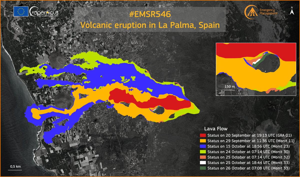
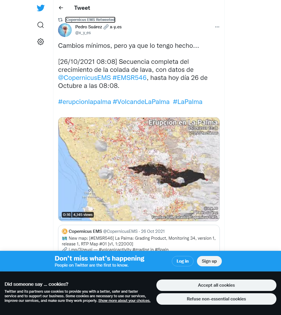
The latest available data on the extent of the lava flows, showing the limited expansion of the flows in the last few days, and the shift of active lava flows in the last week from the northern limits of the flow field to the southern limits of the lava flow field. Image credit: Copernicus EMS
Sources: Government of the Canary Islands, PEVOLCA, Involcan, IGN, DSN, Cabildo La Palma, 112 Canarias, Tolouse VAAC, Copernicus EMS
Lava flows

Earthquakes

Exclusion zone map
Exclusion zones shown here have been approximated from press releases from the Cabildo de La Palma and will not be exact, nor claim to be official maps of the exclusion zones. For official information, please contact the Cabildo de La Palma.

Official social media


To see our full social media archive, visit our open data section or click here.
News articles
- Daily Mirror – Council Leader on La Gomera suggests bombing the lava flows – here
- AS News – CBS confused over location of La Palma volcano – here
To see our full news archive, visit our open data section or click here.
Found a broken web link? We have archived all of our news articles on the WayBack Machine. You can view the pages by 1. pasting the broken link into WayBack Machine and clicking ‘Browse History’ 2. clicking on the latest capture date and then 3. clicking ‘view capture’. Please let us know of any broken web links by contacting us at enquiries@geotenerife.com.
Eruption footage
News and Interviews
Witness Testimonies
Interactive Lava Flow Map
Notes: Use the button in the top right to open the map into full screen mode. Use the legend icon in the top left to see the legend and further information about the map. Click on individual days to see an outline of the lava flows on that day.
Interactive Earthquake Map
click here to enlarge
Notes: The size of the points represents the size of the earthquake, and the colour represents the depth. The map will also only show a certain number of points at once. For ease of use, we recommend you uncheck all dates and the satellite basemap from the legend in the top right, and inspect the earthquakes one day at a time.
Sorry, the comment form is closed at this time.