20 Dec La Palma eruption update 20th December 2021: Dangerous gas levels registered downstream of the lava flow field
La Palma eruption update 20th december 2021: Dangerous gas levels registered downstream of the lava flow field
Daily summary
Volcanic tremor continues at background levels, with no eruptive activity seen, although a reactivation cannot be ruled out. Rigorous monitoring of gas levels throughout the evacuated zones continues, especially in La Bombilla, Puerto Naos and El Remo, where potentially lethal values have been detected on occasion according to PEVOLCA. However, gas levels improved relative to the 19th and permitted access to the evacuated zones from both the north and south, from the land and the sea. Small pockets of incandescence remain around jameos (areas where the roof of a lava tube has collapsed), although this is related to the cooling process of the lava.
At the LP03 station in Jedey, the closest GPS station to the eruption, 8 cm of local uplift was recorded, although it has since reversed by 5 cm and does not change the interpretation of the state of the volcanic processes. PEVOLCA reminds that in the El Hierro eruption, residual seismicity and deformation also occurred as the subsurface re-adjusted. 12 earthquakes were recorded, peaking at M2.3 with 7 <M2.0, largely at intermediate (<20 km) depths.
The SO2 emissions from the plume decreased, registering a very low (5-50 tonnes per day) value. PEVOLCA continues to explain these emissions are due to the solidification of superficial magma in the conduits, rather than magma ascent. Air quality remains good in all stations in relation to SO2, and good to reasonably good in all stations in relation to PM10 particles. However, a pre-alert has been issued by 112 Canarias beginning on the 21st for high rains, winds and thunderstorms, which could remobilise ash deposits.
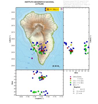
A map showing the earthquakes in the last 36 hours on La Palma. It can be seen the decrease in frequency of earthquakes compared to when eruptive activity was seen, and the low magnitude of most of the recorded earthquakes. Image credit: IGN Spain
Sources: Government of the Canary Islands, PEVOLCA, Involcan, IGN, DSN, Cabildo La Palma, 112 Canarias, Tolouse VAAC, Copernicus EMS
Lava flows

Earthquakes

Exclusion zone map
Exclusion zones shown here have been approximated from press releases from the Cabildo de La Palma and will not be exact, nor claim to be official maps of the exclusion zones. For official information, please contact the Cabildo de La Palma.

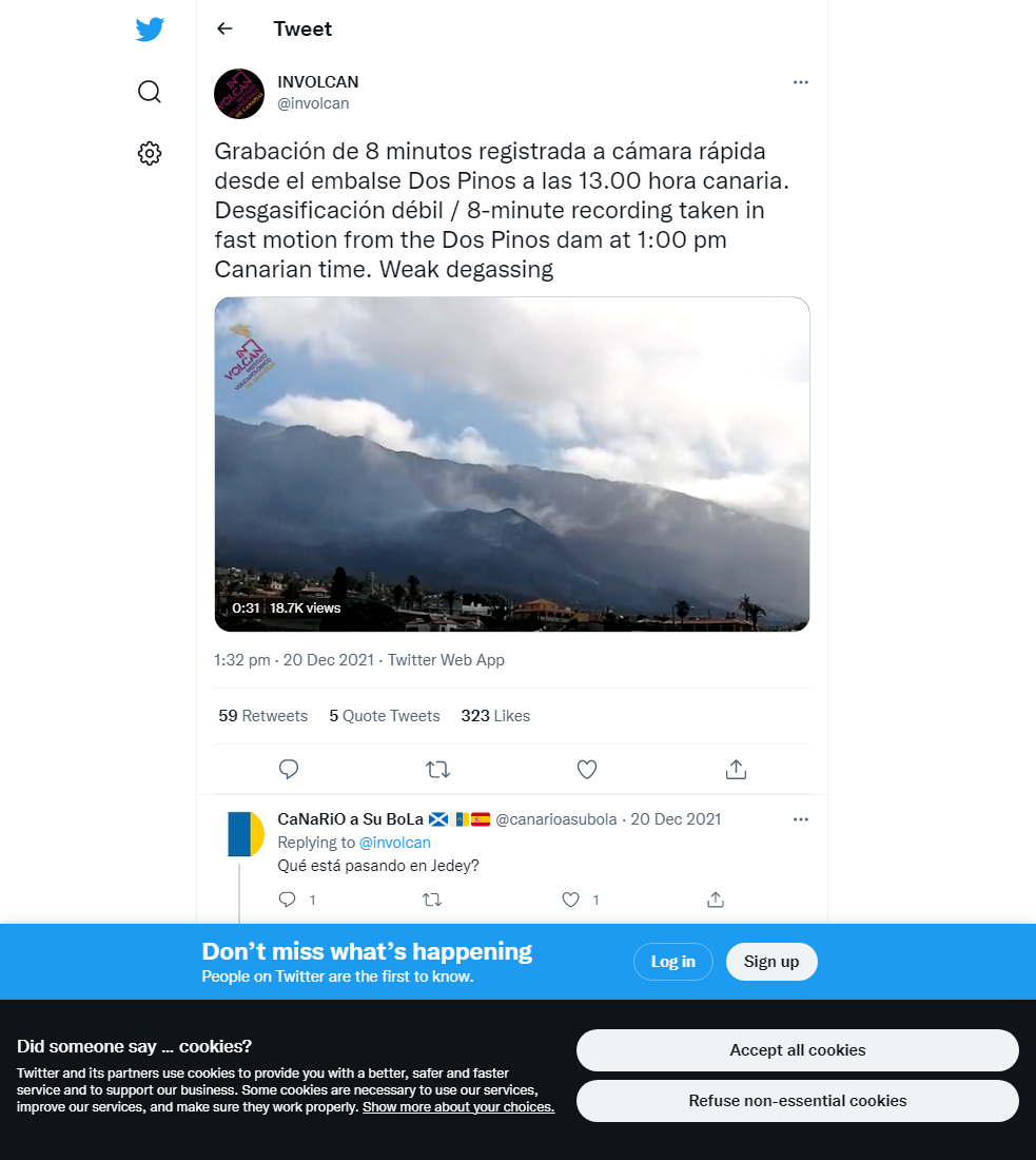
Official social media


To see our full social media archive, visit our open data section or click here.
News articles
- Nasa Earth Observatory – A changed landscape in La Palma – here
- Reuters – Demand erupts for La Palma wine that shares name with the Volcano – here
- Daily Mail – Ronaldo auctions shirt to raise money for La Palma – here
- El Mundo – Latest on the eruption – here
To see our full news archive, visit our open data section or click here.
Found a broken web link? We have archived all of our news articles on the WayBack Machine. You can view the pages by 1. pasting the broken link into WayBack Machine and clicking ‘Browse History’ 2. clicking on the latest capture date and then 3. clicking ‘view capture’. Please let us know of any broken web links by contacting us at enquiries@geotenerife.com.
Eruption footage
News and Interviews
Witness Testimonies
Interactive Lava Flow Map
Notes: Use the button in the top right to open the map into full screen mode. Use the legend icon in the top left to see the legend and further information about the map. Click on individual days to see an outline of the lava flows on that day.
Interactive Earthquake Map
click here to enlarge
Notes: The size of the points represents the size of the earthquake, and the colour represents the depth. The map will also only show a certain number of points at once. For ease of use, we recommend you uncheck all dates and the satellite basemap from the legend in the top right, and inspect the earthquakes one day at a time.
Sorry, the comment form is closed at this time.