21 Sep La Palma eruption update 21st September 2021: Lava slowly advances
La Palma eruption update 21st september 2021: Lava slowly advances
Daily summary
As the eruption enters its third day, no casualties or personal injuries from the eruption continue to be reported. However, the first provisional damage assessment has been published which estimates that 185 buildings have been affected, 63 of which are homes according to the Land Registry. The lava flow now has two fronts; a northern front which is closer to Todoque, and a southern front which is largely stopped for the moment. The advance of the active flow front is slowing relative to previous days, however. The eruption continues to show a strombolian mechanism along the NW-SE fissure from four main vents. An episode of greater explosivity was observed from 7pm local time onwards, which peaked at 9pm. The gas plume continues to reach about 3000m according to the Tolouse Volcanic Ash Advisory Centre (VAAC), and the SO2 flux is estimated at between 6,140-11,500 tons per day.
Concerning geophysical parameters, the volcanic tremor has seen a decrease in amplitude attributed to the eruption centring around only four vents, compared to 7 or more in the first hours of the eruption. The rate of inflation of the ground close to the eruption has also decreased, and InSAR measurements show an average cumulative maximum deformation of 28cm since the seismic swarm began. Monitoring priorities include collecting ash and lava sampling, modelling the speed and direction of advance of the lava flows, and monitoring the amount and composition of gases emitted by the volcano.
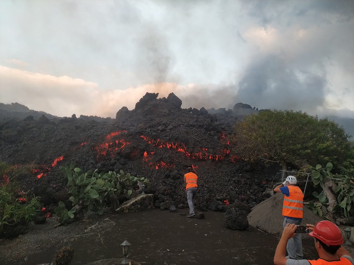
A team of volcanologists inspect the front of the active lava flow near Todoque. Image credit: INVOLCAN
Sources: Government of the Canary Islands, PEVOLCA, Involcan, IGN, DSN, Cabildo La Palma, 112 Canarias, Tolouse VAAC
Lava flows

Earthquakes

Exclusion zone map
Exclusion zones shown here have been approximated from press releases from the Cabildo de La Palma and will not be exact, nor claim to be official maps of the exclusion zones. For official information, please contact the Cabildo de La Palma.
")
Official social media
To see our full social media archive, visit our open data section or click here.
News articles
- BBC News – Eruption and evacuation – here
- Guardian – More evacuations due to the eruption – here
- Independent– Fears of lava hitting the sea – here
- El País – Seven dangers from the eruption – here
To see our full news archive, visit our open data section or click here.
Found a broken web link? We have archived all of our news articles on the WayBack Machine. You can view the pages by 1. pasting the broken link into WayBack Machine and clicking ‘Browse History’ 2. clicking on the latest capture date and then 3. clicking ‘view capture’. Please let us know of any broken web links by contacting us at enquiries@geotenerife.com.
Eruption footage
News and Interviews
Witness Testimonies
Interactive Lava Flow Map
Notes: Use the button in the top right to open the map into full screen mode. Use the legend icon in the top left to see the legend and further information about the map. Click on individual days to see an outline of the lava flows on that day.
Interactive Earthquake Map
click here to enlarge
Notes: The size of the points represents the size of the earthquake, and the colour represents the depth. The map will also only show a certain number of points at once. For ease of use, we recommend you uncheck all dates and the satellite basemap from the legend in the top right, and inspect the earthquakes one day at a time.
Sorry, the comment form is closed at this time.