24 Dec La Palma eruption update 24th December 2021: Lack of eruptive activity continues
La Palma eruption – 24th December 2021
Daily summary
Volcanic tremor continues at background levels, with no eruptive activity seen, although a reactivation cannot be ruled out. If the current levels are maintained, the authorities will be able to call an end to the eruptive process on the 25th December. PEVOLCA reminds the population however that end of the eruption does not mean the end of the dangers from the volcano, and that declaring the end of this eruption is not the same as declaring the end of the magmatic reactivation in Cumbre Vieja.
The deformation recorded at the LP03 station in Jedey that began on December 19th, the closest GPS station to the eruption, has now fully reversed. Across the rest of the network, no other trends are seen across the deformation network. PEVOLCA again reminds that in the El Hierro eruption, residual seismicity and deformation also occurred as the subsurface re-adjusted. 16 earthquakes were recorded, peaking at M3.0 with 10 <M2.0, largely at intermediate (<20 km) depths.
The level of SO2 emissions from the plume were maintained from the previous days, registering a low (50-500 tonnes per day) value. PEVOLCA continues to explain these emissions are due to the solidification of superficial magma in the conduits, rather than magma ascent. Evacuated people looking to enter homes must always be accompanied and permanent ventilate the homes, waiting 15 minutes before entering and not entering underground areas. Air quality remains good in all stations with respect to SO2 concentrations, and between good to reasonably good in all stations with respect to PM10 concentrations.
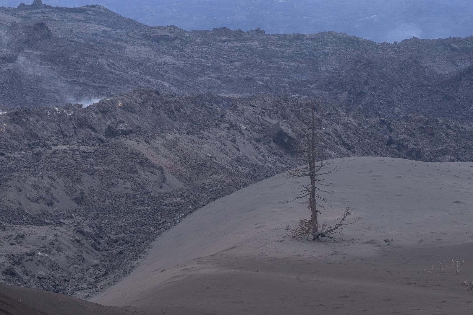
The cooling lava flows at the north of the lava flow field, showing the thickness of the flows and ashfall, relative to a scorched pine tree. Image credit: Government of the Canary Islands, 112 Canarias
Sources: Government of the Canary Islands, PEVOLCA, Involcan, IGN, DSN, Cabildo La Palma, 112 Canarias, Tolouse VAAC, Copernicus EMS
Lava flows

Earthquakes

Exclusion zone map
Exclusion zones shown here have been approximated from press releases from the Cabildo de La Palma and will not be exact, nor claim to be official maps of the exclusion zones. For official information, please contact the Cabildo de La Palma.

Official social media
To see our full social media archive, visit our open data section or click here.
News articles
- SpainsNews – Lava from the volcano ‘comes out’ from La Laguna – here
- Earth – Months of eruption has transformed La Palma – here
- Yahoo news – Soldiers begin La Palma volcano clean up – here
- RTVE – Latest on the eruption – here
To see our full news archive, visit our open data section or click here.
Found a broken web link? We have archived all of our news articles on the WayBack Machine. You can view the pages by 1. pasting the broken link into WayBack Machine and clicking ‘Browse History’ 2. clicking on the latest capture date and then 3. clicking ‘view capture’. Please let us know of any broken web links by contacting us at enquiries@geotenerife.com.
News and Interviews
Witness Testimonies
Interactive Lava Flow Map
Notes: Use the button in the top right to open the map into full screen mode. Use the legend icon in the top left to see the legend and further information about the map. Click on individual days to see an outline of the lava flows on that day.
Interactive Earthquake Map
click here to enlarge
Notes: The size of the points represents the size of the earthquake, and the colour represents the depth. The map will also only show a certain number of points at once. For ease of use, we recommend you uncheck all dates and the satellite basemap from the legend in the top right, and inspect the earthquakes one day at a time.
Sorry, the comment form is closed at this time.