24 Nov La Palma eruption update 24th November 2021: The new lava delta already covers 5 hectares
La Palma eruption – 24th November 2021
Daily summary
Rain warnings have been issued for La Palma in the coming days, which PEVOLCA has warned could remobilise unconsolidated ash deposits which may form local mass movements and present a hazard to driving, especially in steep areas. Meanwhile, the dispersion of the ash and gas plume continues to be to the E/NE and are unfavourable to the operations of the airport. The new lava delta to the north now occupies 5 hectares and already extends a maximum of 350 m from the cliffs. Lava flows 1, 2 and 9, which feed the southern lava delta, continue to be active as well. Seismicity decreased relative to the last few days, with a decrease seen especially in deep earthquakes. 46 events were recorded, with only a slightly lower proportion of intermediate (10-15 km depth) events to deep (30-45 km depth) events, and the day’s largest earthquake was a mbLg 3.4 event at 13 km depth.
Volcanic tremor remains low with some occasional fluctuation, whilst deformation now remains fairly stable across the whole network. SO2 emissions were reported to be estimated at a high level, between 1,000-29,999 tons per day, reflecting a change in the reporting of this parameter, whilst the ash and gas plume was measured at 4,300 m. As a general trend however, satellite measurements imply current SO2 emissions are lower than the start of the eruption. SO2 levels were between good and reasonably good in all stations in most of the day, but multiple exceedances of the hourly limit value (250 μg/m3) in the early hours at El Paso and Los Llanos led to the exceedance of the daily limit value (125 μg/m3) in Los Llanos. With respect to PM10 levels, the daily limit value (50 μg/m3) was exceeded in Los Llanos, although PM10 values in the east of the island have improved, and all other stations were at good or reasonably good levels.
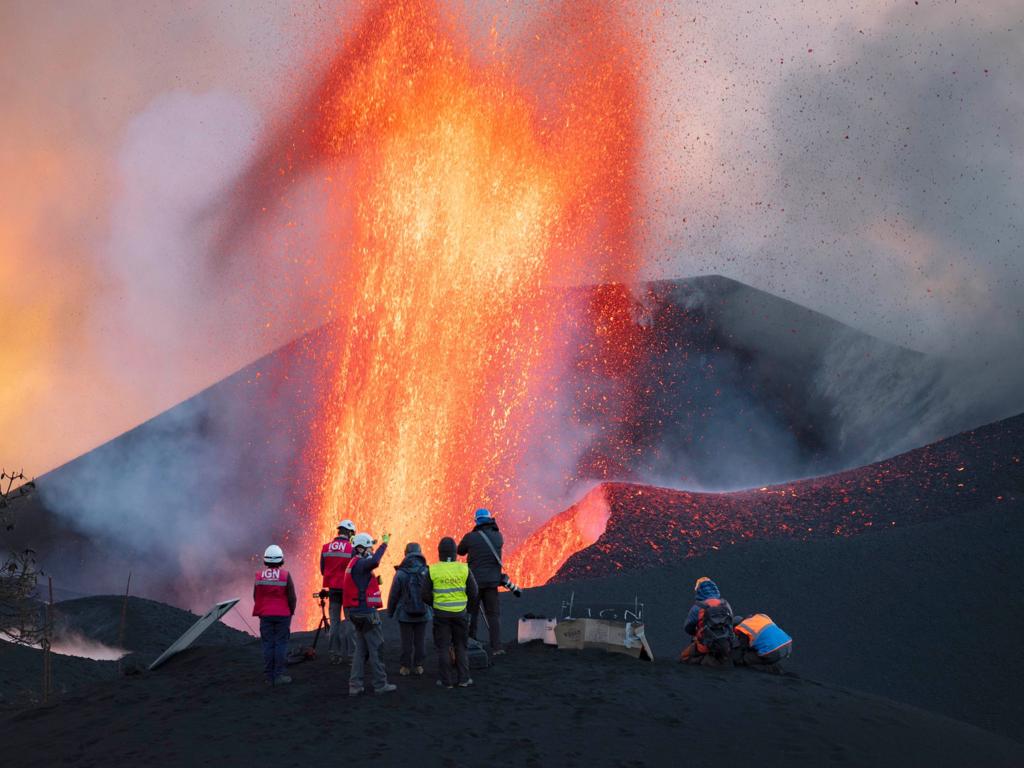
A group of IGN volcanologists conduct measurements and maintenance tasks to equipment close to the main cone on the 24th. Image credit: IGN Spain, Arturo Rodríguez
Sources: Government of the Canary Islands, PEVOLCA, Involcan, IGN, DSN, Cabildo La Palma, 112 Canarias, Tolouse VAAC, Copernicus EMS
Lava flows

Earthquakes

Exclusion zone map
Exclusion zones shown here have been approximated from press releases from the Cabildo de La Palma and will not be exact, nor claim to be official maps of the exclusion zones. For official information, please contact the Cabildo de La Palma.

Official social media
To see our full social media archive, visit our open data section or click here.
News articles
- Daily Express – La Palma volcano warning: ‘Unstoppable’ lava clocked at record speeds of 10m per second – here
- Reuters – Lockdown lifted in Spain’s La Palma, volcanic eruption keeps airport shut – here
- CascadeUAV – UAS response to the volcanic eruption in La Palma – here
To see our full news archive, visit our open data section or click here.
Found a broken web link? We have archived all of our news articles on the WayBack Machine. You can view the pages by 1. pasting the broken link into WayBack Machine and clicking ‘Browse History’ 2. clicking on the latest capture date and then 3. clicking ‘view capture’. Please let us know of any broken web links by contacting us at enquiries@geotenerife.com.
Eruption footage
News and Interviews
Witness Testimonies
Interactive Lava Flow Map
Notes: Use the button in the top right to open the map into full screen mode. Use the legend icon in the top left to see the legend and further information about the map. Click on individual days to see an outline of the lava flows on that day.
Interactive Earthquake Map
click here to enlarge
Notes: The size of the points represents the size of the earthquake, and the colour represents the depth. The map will also only show a certain number of points at once. For ease of use, we recommend you uncheck all dates and the satellite basemap from the legend in the top right, and inspect the earthquakes one day at a time.
Sorry, the comment form is closed at this time.