09 Nov La Palma eruption update 9th November 2021: A second lava stream has reached the coast
La Palma eruption – 9th November 2021
Daily summary
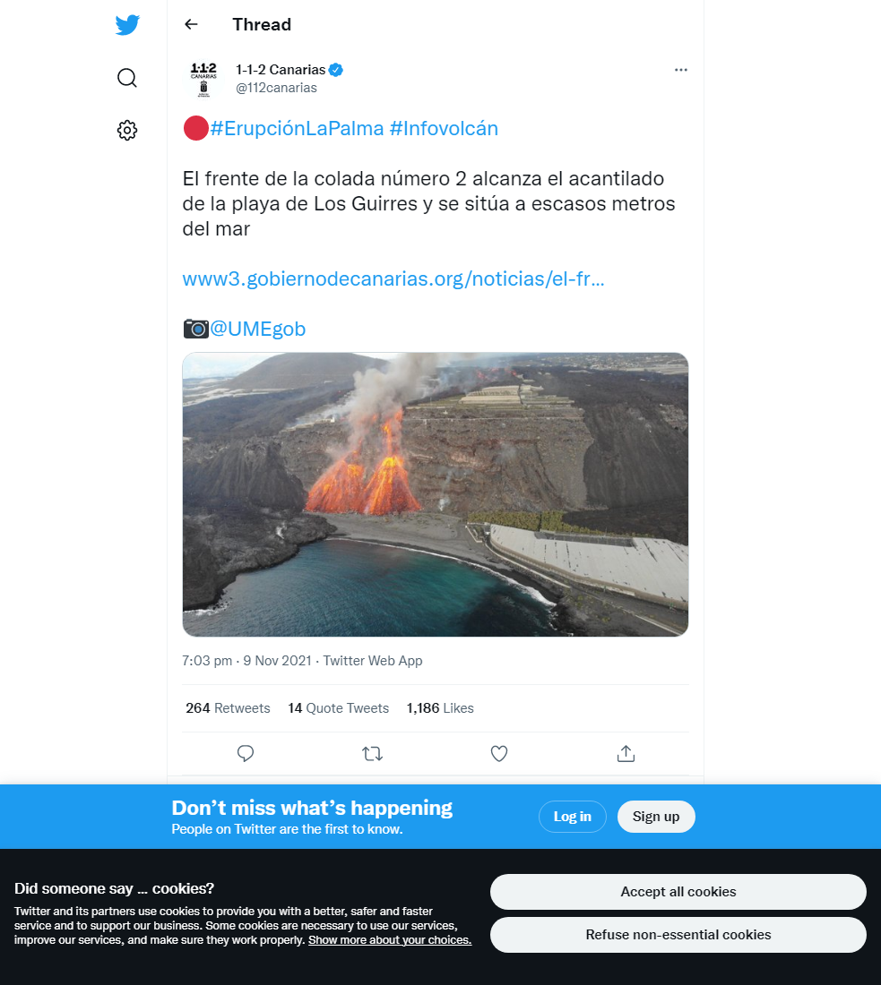
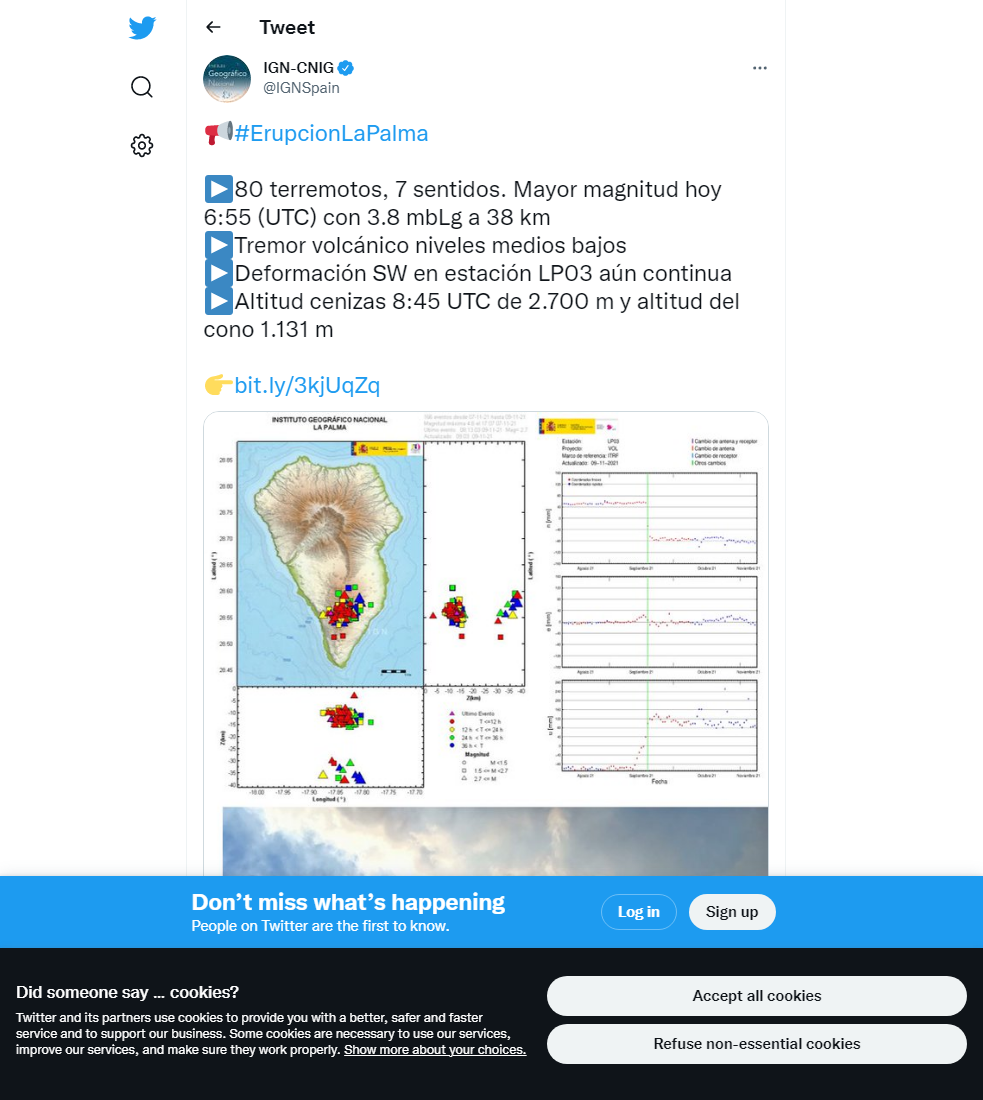
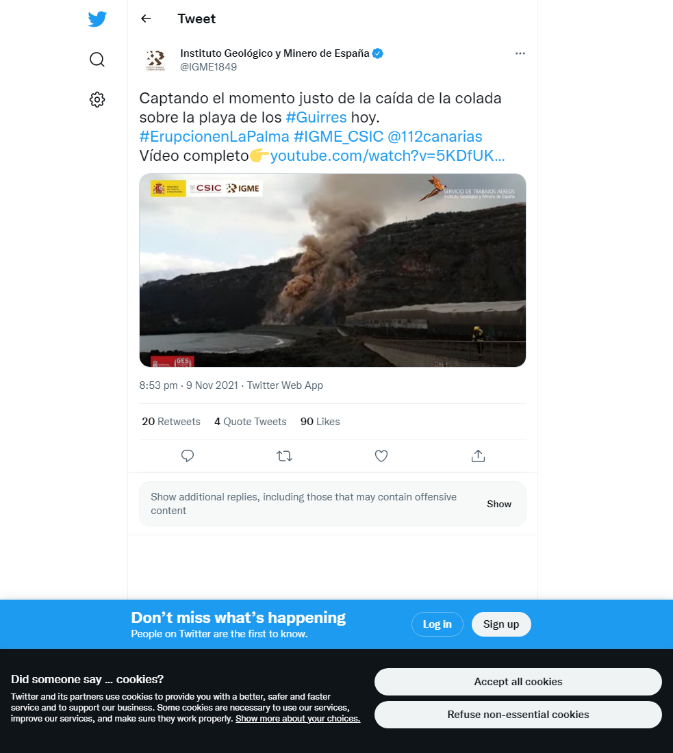
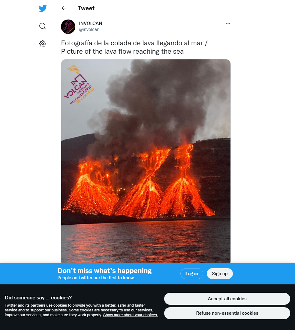
The lava flow immediately south of the current lava delta, flow number 2, has advanced and reached the coast at Playa de Los Guirres. The front of the lava flow is cascading down the cliffs onto the beach below, although this lava is yet to make contact with the sea. The rest of the active lava flows however show minimal progress. The eruptive activity continues to be a mixed strombolian mechanism with more explosive strombolian vents within the main cone, a lava emission vent on the NW flank of the main cone, and occasional phreatomagmatic pulses. The number of earthquakes increased again to 99, being recorded mostly at intermediate (10-15 km) depths with some deeper (35-40 km depth) events too, with the day’s largest earthquake being a mbLg 3.8 event at 38 km depth. This is still lower than the earthquake strength and frequency at points in the previous week.
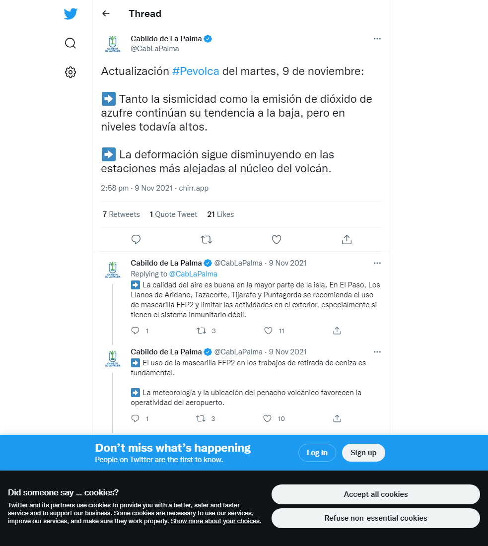
At the closest GPS station to the eruption (LP03) near Jedey, some variable deformation reflecting eruption dynamics continue to be seen, with slight regional deflation seen at the rest of the stations. SO2 emissions showed a marked increase, at 31,000-43,000 tons per day, whilst the ash and gas plume reached 2700 m. However, satellite measurements imply current SO2 emissions show a downward trend since the start of the eruption. Currently, tremor remains fairly stable at low levels as it has done for the last 48 hours. In general, air quality has shown some improvements relative to previous days. SO2 levels were good-reasonably good in all stations except Puntagorda which was at regular levels and exceeded the daily threshold (125 μg/m3). PM10 concentrations were much lower in Los Llanos and reached regular levels, and in the rest of the stations the levels remained at reasonably good to good levels. Because of this, none of the stations exceeded the daily threshold (50 μg/m3) with respect to PM10.
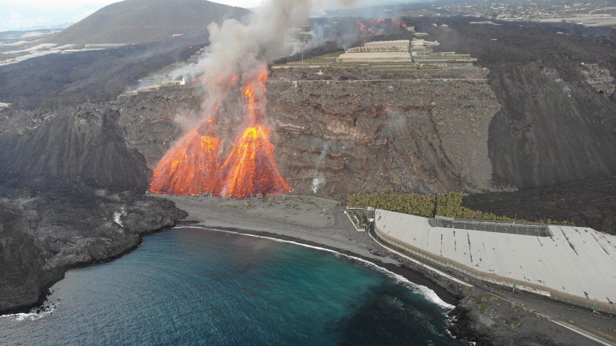
A photo taken by drone showing the new lava stream cascading onto the beach immediately south of the first lava delta (left). The low land to the right of the image is part of the lava delta created during the 1949 eruption on the island. Image credit: Government of the Canary Islands, PEVOLCA
Sources: Government of the Canary Islands, PEVOLCA, Involcan, IGN, DSN, Cabildo La Palma, 112 Canarias, Tolouse VAAC, Copernicus EMS
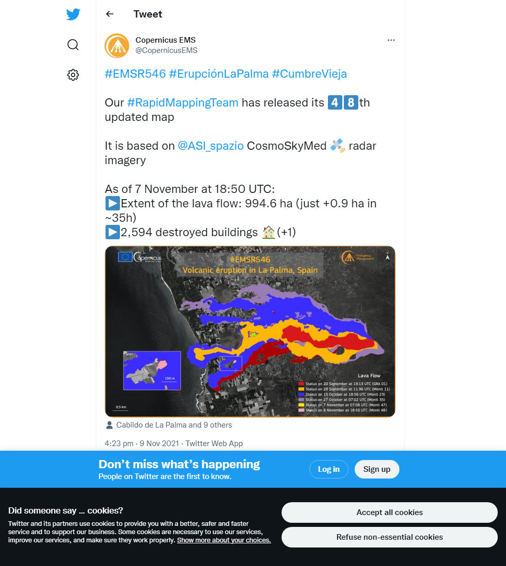
Lava flows

Earthquakes

Exclusion zone map
Exclusion zones shown here have been approximated from press releases from the Cabildo de La Palma and will not be exact, nor claim to be official maps of the exclusion zones. For official information, please contact the Cabildo de La Palma.

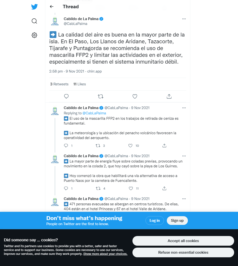
Official social media

To see our full social media archive, visit our open data section or click here.
News articles
- El Pais – Deepest magma reserves appear to be falling – here
- Volcano Discovery – Lava flows reach coast at new point – here
To see our full news archive, visit our open data section or click here.
Found a broken web link? We have archived all of our news articles on the WayBack Machine. You can view the pages by 1. pasting the broken link into WayBack Machine and clicking ‘Browse History’ 2. clicking on the latest capture date and then 3. clicking ‘view capture’. Please let us know of any broken web links by contacting us at enquiries@geotenerife.com.
Eruption footage
News and Interviews
Witness Testimonies
Interactive Lava Flow Map
Notes: Use the button in the top right to open the map into full screen mode. Use the legend icon in the top left to see the legend and further information about the map. Click on individual days to see an outline of the lava flows on that day.
Interactive Earthquake Map
click here to enlarge
Notes: The size of the points represents the size of the earthquake, and the colour represents the depth. The map will also only show a certain number of points at once. For ease of use, we recommend you uncheck all dates and the satellite basemap from the legend in the top right, and inspect the earthquakes one day at a time.
Sorry, the comment form is closed at this time.