13 Sep La Palma update 13th september 2021: PEVOLCA Activated
La Palma update 13th september 2021: PEVOLCA Activated
Daily summary
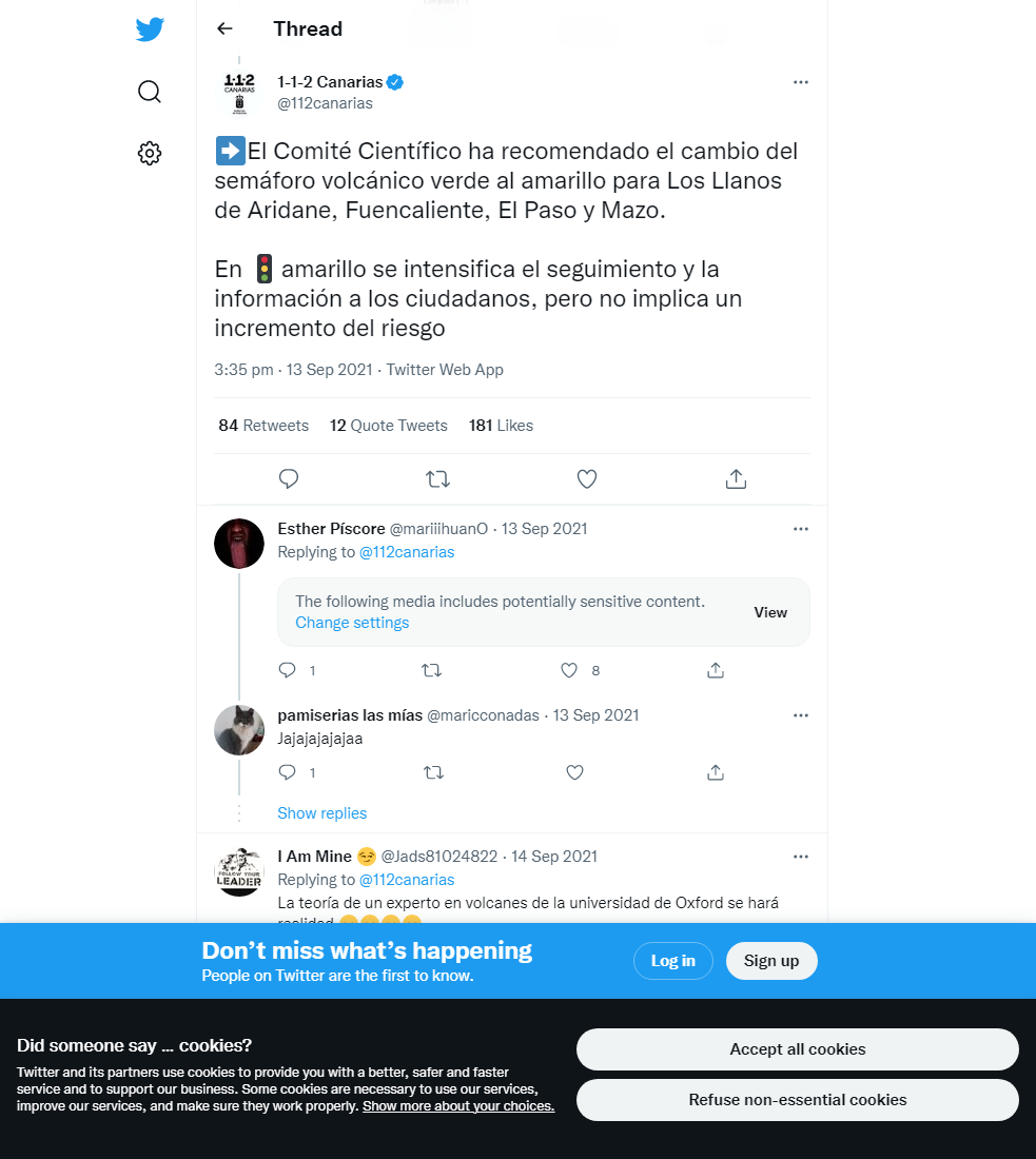
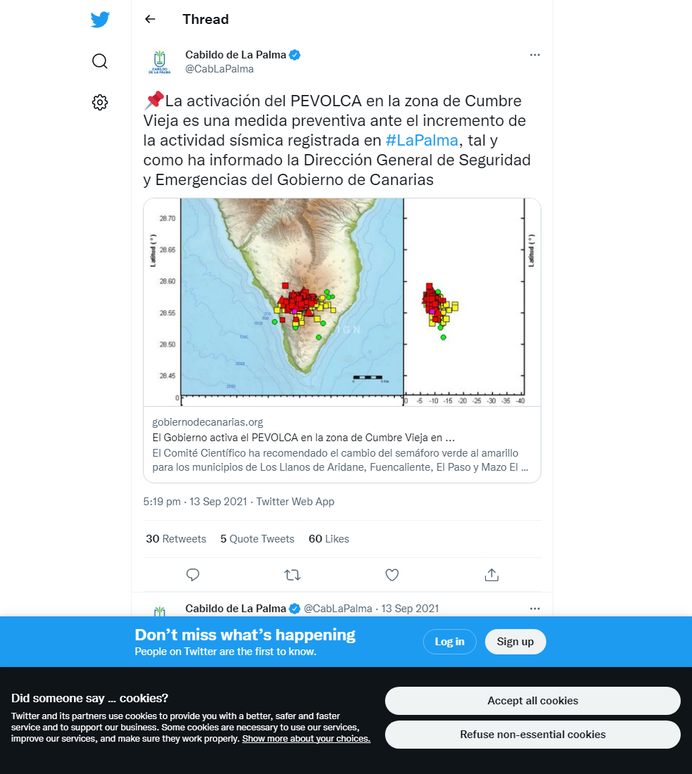
Today, in the wake of the intensifying seismic swarm on La Palma that began on the 11th September, the Government of the Canary Islands have activated the Scientific Committee of the Special Plan for Civil Protection and Attention to Emergencies due to Volcanic Risk (PEVOLCA). Alongside this activation, the volcanic traffic light alert system has been raised from green to yellow in the municipalities of Fuencaliente, Los Llanos de Aridane, El Paso and Mazo. The yellow traffic light allows for an intensification of communication to the population, volcano and seismic monitoring, as well as increased surveillance.
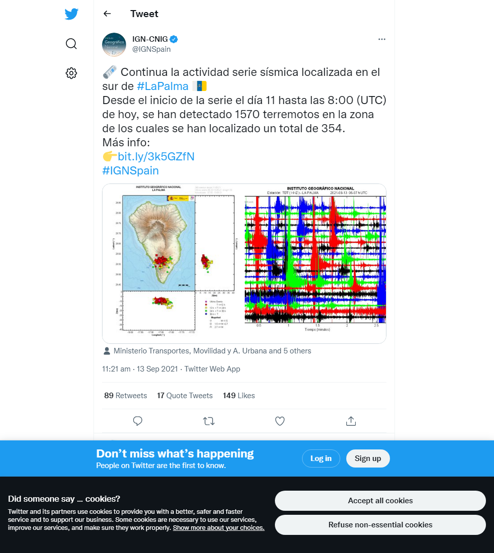
Since the swarm started, there have been more than 400 earthquakes, some of which have been felt by the population. The swarm represents the 9th seismic swarm in southern La Palma since anomalous seismic activity began in the area in October 2017. This current swarm is the most intense of any of these swarms, and is also significant in that the majority of the earthquakes are shallower at around 12 km depth, relative to previous swarms that have taken place at 20-30 km depth. Furthermore, Helium-3 emission data, the ratios of which can be used to infer the source of the swarm, register the highest values seen in 30 years, and confirm a magmatic source for the current activity.
Sources: Government of the Canary Islands, PEVOLCA, Involcan, IGN, DSN, Cabildo La Palma, 112 Canarias
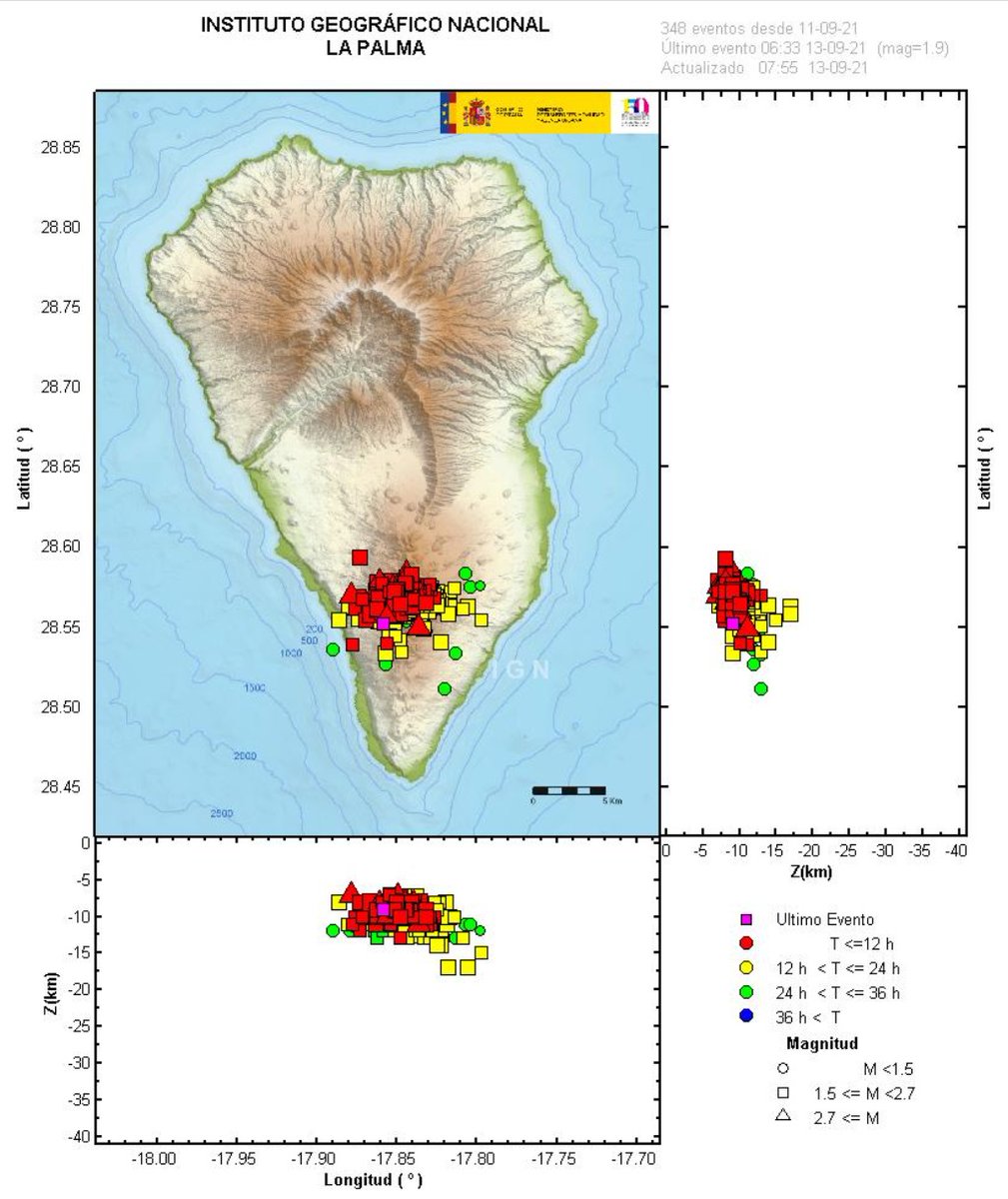
A map of the location and magnitude of the earthquakes since the start of the seismic swarm on the 11th. Image credit: IGN
Earthquakes

Official social media

To see our full social media archive, visit our open data section or click here.
News articles
- Canarian Weekly – Earthquake swarm and alert level – here
- Guide to Canary Islands – Earthquake swarm and alert level – here
To see our full news archive, visit our open data section or click here.
Found a broken web link? We have archived all of our news articles on the WayBack Machine. You can view the pages by 1. pasting the broken link into WayBack Machine and clicking ‘Browse History’ 2. clicking on the latest capture date and then 3. clicking ‘view capture’. Please let us know of any broken web links by contacting us at enquiries@geotenerife.com.
News and Interviews
Witness Testimonies
Interactive Lava Flow Map
Notes: Use the button in the top right to open the map into full screen mode. Use the legend icon in the top left to see the legend and further information about the map. Click on individual days to see an outline of the lava flows on that day.
Interactive Earthquake Map
click here to enlarge
Notes: The size of the points represents the size of the earthquake, and the colour represents the depth. The map will also only show a certain number of points at once. For ease of use, we recommend you uncheck all dates and the satellite basemap from the legend in the top right, and inspect the earthquakes one day at a time.
Sorry, the comment form is closed at this time.