14 Sep La Palma update 14th September 2021: Seismic swarm intensifies
La Palma update 14th september 2021: Seismic swarm intensifies
Daily summary
The seismic swarm continues to shallow as well as increase in both frequency and intensity, although the volcanic alert level traffic light for La Palma remains at Yellow. 311 earthquakes were recorded, the most on a single day since the swarm began, with the largest earthquake being a mbLg 3.5 at 9 km depth. The average depth of earthquakes continued to drop, from 10 km on the 12th to 9.2 km on the 13th to now 8.8 km on the 14th.
The total number of earthquakes since the swarm started on the 11th is now over 800, with an increasing number of events being felt by the population. The swarm represents the 9th seismic swarm in southern La Palma since anomalous seismic activity began in the area in October 2017. This current swarm is the most intense of any of these swarms, and is also significant in that the majority of the earthquakes are shallower relative to previous swarms that have taken place at 20-30 km depth. Furthermore, Helium-3 emission data, the ratios of which can be used to infer the source of the swarm, register the highest values seen in 30 years, and confirm a magmatic source for the current activity.
Sources: Government of the Canary Islands, PEVOLCA, Involcan, IGN, DSN, Cabildo La Palma, 112 Canarias
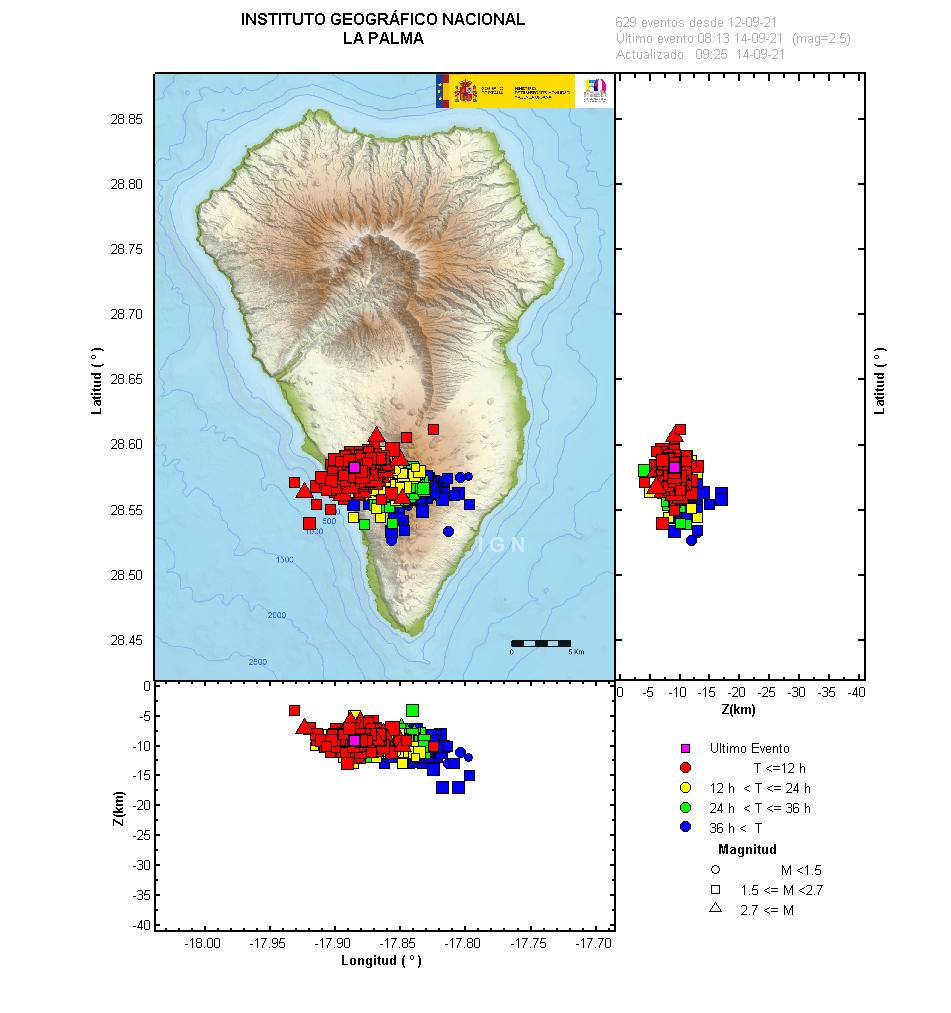
A map of the location and magnitude of the earthquakes since the start of the seismic swarm on the 11th. Image credit: IGN
Earthquakes

Official social media
To see our full social media archive, visit our open data section or click here.
News articles
- Daily Mirror – Earthquake swarm and alert level – here
To see our full news archive, visit our open data section or click here.
Found a broken web link? We have archived all of our news articles on the WayBack Machine. You can view the pages by 1. pasting the broken link into WayBack Machine and clicking ‘Browse History’ 2. clicking on the latest capture date and then 3. clicking ‘view capture’. Please let us know of any broken web links by contacting us at enquiries@geotenerife.com.
News and Interviews
Witness Testimonies
Interactive Lava Flow Map
Notes: Use the button in the top right to open the map into full screen mode. Use the legend icon in the top left to see the legend and further information about the map. Click on individual days to see an outline of the lava flows on that day.
Interactive Earthquake Map
click here to enlarge
Notes: The size of the points represents the size of the earthquake, and the colour represents the depth. The map will also only show a certain number of points at once. For ease of use, we recommend you uncheck all dates and the satellite basemap from the legend in the top right, and inspect the earthquakes one day at a time.
Sorry, the comment form is closed at this time.