For each of our ongoing research projects with our collaborating researchers, our students and interns produce a report summarising the background, methods, and results of the research project. Below is a selection of reports produced by our students and interns.
If you are interested further in any of these research projects, or would like to set up your own research project with us, please let us know by getting in touch with us at enquiries@geotenerife.com.
The La Palma Project GeoIntern Research Reports
Survey of Volcanically-Induced Strain in El Corazoncillo, El Paso, La Palma, Canary Islands (2024)
Guro Lilledal Andersen1,2 Chun Hei Ho1,3 Shreya Kapitzki1,4 Rosana López Romero1,5 Saskia Willar-Sheehan1,6
1 GeoTenerife 2 University of Oslo 3 Uppsala University 4 Cardiff University 5 Manchester Metropolitan University 6 Durham University
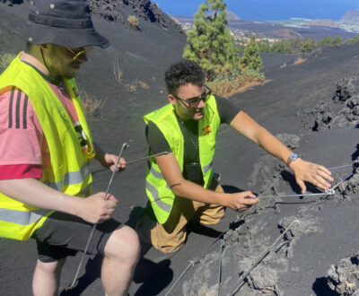
This report examines ground deformation along El Corazoncillo road in El Charol, La Palma, affected by the 2021 Tajogaite eruption. The study analyses cracks, strain and strike patterns to infer magma movement and dyke emplacement. Findings indicate significant strain at the northern end of the road, with cracks primarily oriented east-west, consistent with dyke intrusion theories.
Drone surveys of the 2021 La Palma eruption products – with Fernando Borràs Castelló (Drones for Geology, Spain) (2022)
Written by Jacob Nash, University of Bristol
Abstract
On 19/09/2021 a basaltic fissure eruption began at Tajogaite Volcano located on the Cumbre Vieja Ridge, following a series of seismic swarms recorded since 2017. Lava flows travelled west up to 6.5 km to the shore and continued 1.1 km into the sea forming a lava delta. Six zones of interest within the lava flows were identified for the aerial surveys. The aim was to investigate the zones of interest surrounding the 2021 lava flows/deltas and the 1949 lava deltas to identify geomorphological and ecological changes using drone technology. Aerial flights were performed at all six zones of interest using the DGI Maverick 2Pro Drone and two flights were undertaken to photograph the underwater sections of the 2021 lava deltas using the FIFISH V6 drone. Photos taken during the aerial surveys were analysed using DCIM PIX4D. DPC models and DEMs of the northern and southern 2021 Lava slopes and deltas and the main Tajogaite cone were developed. For future aerial surveys, we recommend focused flights on individual structures within the lava flows, specifically structures that may change over short periods e.g. levees.
Science Communication on La Palma – A GeoIntern’s experience (2022)
Written by Divas Parashar
Excerpt
Personally, it was a humbling experience for me to be able to talk to residents and hear their stories about the eruption and everything that has happened as a result of it. They spoke to us about the problems they are facing, ranging from uncertainty and confusion regarding the reconstruction and rehabilitation efforts, the unavailability of the promised help from the local government and the slow progress in everything. We also realized that there exists a strong fear amongst the residents that the volcano might reactivate and cause more damage in the coming weeks or months. This speaks volumes about the lack of proper scientific communication by the scientists and officials. Many of their lives have changed forever after the eruption, but there exists hope for a better future.
Weathering and bio-availability of basaltic lavas on La Palma – with Dr David Foster (University of Florida, USA) (2022)
Written by Ajay Wynne Jones and Kelsey Hewett
Abstract
To understand the processes that are the most important for making volcanic material bioavailable and thus how volcanic rocks may have affected the evolution of early life we collected samples of lava flows across many ages. The permit gathered for this project allowed 6 sample locations. The locations selected from the permit are representative of mid and low altitudes of the 2021, 1949 and 1585 lava flows. Samples were collected from the centre of the flows and only at the surface. This was done to reduce any possible contamination from the lava flow margins. the method for collecting samples included filling out a table indicating the date of collection, lava flow age, sample name (e.g. GT-LP-21.1), sample type (rock or tephra), location using UTM, and elevation with any error if given. Future research for La Palma includes trying to get a permit approved for other lava flows, including the 1430 lava flow just north of the 2021 flow, the 1712 lava flow south of 1585, and the 1971 and 1677 flows at the southernmost portion of the island.
La Palma reactivation simulation – with Jaime Coello and Alvaro Márquez González (Complutense University Madrid, Spain) (2022)
Written by Anabel Pozniak and Gemechu Bedassa
Abstract
This report aims to assess the risk of an imminent effusive eruption in La Palma within the Cumbre Vieja Natural Park if seismic trends continue to occur in this region. The Cumbre Vieja is an active 25-km-long volcanic ridge on the southern flank of the island La Palma in the Canary Islands, there are approximately 67,839 people who live on either side of the ridge and therefore are vulnerable to volcanic eruptions. In this work, seismic data recorded across the last 90 days across La Palma by the Instituto Geográfico Nacional, seismic data recorded before the 2021 Tajogaite eruption, and the location of the historic vent, and hydromagmatic eruption locations were used to predict the future eruption to occur in the southern volcanic domain of the Island. Our model predicts the eruption is most likely to occur to the NW of Lavas la Malforda on the western flank of the Cumbre Vieja ridge. The eruption will likely be a strombolian magmatic eruption, with a 57% chance of also being Hawaiian. If an eruption was likely to occur, it is 100% likely to have expansive lava flows, tephra/ash falls and toxic gases. This eruption has the potential to impact the villages of El Remo and El Charco, many banana plantations, and the LP-2 and LP-210 roads.
Vegetation surveys on La Palma lava flows with Dr Katy Chamberlain (Teesside University, UK) (2022)
Written by Sofia Della Sala and Brannock Hackett
Abstract
It is important to understand how various types of vegetation may colonise lava flows and over what timescales, to be able to monitor the development of vegetation on lava flows. In this study, the vegetation of lava flows was investigated for lava flows of different ages on the Canary Island of La Palma. The amount and maturity of vegetation of lava flows from eruptions in 1677, 1949, and 1971 were studied. Quadrants of 1 x 1 m were chosen at random, and the features of the rocks as well as the presence of any vegetation were recorded. Lichen colonisation and diversity increased with the age of the lava flows, however, even the older lava flows lacked more complex vegetation.
The Volcanic Readiness Project GeoIntern Research Reports
VOLCANIC RESILIENCE IN VILAFLOR DE CHASNA (2024)
Queay, Isabel¹, Glover, Jack²; Piccoli, Brooke³; Cano Fortún, Carmen⁴; Cabrera, Javier Díaz⁵; Kambale Kavyavu, Wisdo⁶
¹University of Glasgow, ²University of Exeter; ³University of Florida; Università di Napoli Federico II⁴; Graduate of University of Stirling⁵; University of Québec in Montrea⁶
Abstract
Volcanoes pose a significant threat to the people of Tenerife, and the people who live the must have a certain amount of resilience to tackle this. This is shown by the 2021 eruption of La Palma, where many of the residents are still recovering from the impacts today. This report looks at the municipality of Vilaflor de Chasna, how much the people are aware of the volcanic risk, and how they would react when an eruption does happen. Data collection involved creating a survey and asking the residents of the town questions about demographics, volcanic knowledge, who they would contact in an emergency and how they feel about the current emergency systems. We asked questions that would allow us to gauge the vulnerability of the town, such as how many dependents residents have and whether they would require assistance during an evacuation. Additionally, we also interviewed some of the local figures such as the Mayor, Nuns and Firemen who gave information on the volcanic readiness of the town. From this data, we were able to learn some key information about the local volcanic knowledge and the institutions that people trust to give accurate knowledge. As we completed our data collection we were able to reflect on some of the issues that we faced. For example, the lack of Spanish-speaking researchers in our group, as they were the ones who could effectively talk to respondents, and the limited amount of time that we were able to spend in Vilaflor de Chasna. It is critical that volcanic resilience is built within the population of Tenerife in order to mitigate the impacts as much as possible; this can be achieved through education of the population and targeting weak spots in the current emergency plans.
Volcanic resilience and preparedness on the island of Tenerife (2023)
Alec Phipps-Wirtz [1], Faith Bowater [2], Holly Shipp [3], Noah Gompertz [4], Rahma Hassan [5], and Samuel Swale [6]
1 University of Utah, 2 University of Plymouth, 3 Edge Hill University, 4 Coventry University, 5 University of Birmingham, 6 Bangor University.
Abstract
Tenerife is the largest of the volcanic islands that make up an archipelago off the coast of North West Africa. It is volcanically active, with a historical record of basaltic fissure eruptions that occur along its rift zones, as well as more explosive sub-Plinian eruptions from the central Teide-Pico Viejo Complex. Tenerife’s PAIV – The Island Action Plan Against Volcanic Risk – identifies the areas of greatest threat are the Abeque Ridge, the Icod-Garachico Valley, and Santiago del Teide-Guía de Isora and that 60,000 people live in areas with a high or very high “volcanic threat” in Tenerife. Thus, it is of great importance that the residents of Tenerife are prepared for volcanic eruption and resilient to the effects of volcanic activity. The preparedness and resilience of the island to volcanic hazards were assessed and were found to be insufficient; The island and the local people are heavily dependent on tourism for economic growth, and a lack of education regarding Tenerife’s volcanic risk was reflected in the responses to the surveys carried out, information is not communicated effectively, and existing resources are not accessible. The following recommendations were made to reduce vulnerability: creating education programmes to increase hazard awareness and preparedness, diversification of the economy to ensure sustainable development and to reduce economic impacts of the eruption, and improvements in risk communication and accessibility of resources. Municipalities in the North and North West should be prioritised since they are most at risk.
Volcanic public preparedness surveys in Tenerife and La Palma with Dr Catalina Arguello (Universidad Internacional de La Rioja (2022)
Written by Megan Pelly, Ella Richmond, and Lucy Benniston
Abstract
The Canary Islands are a group of volcanic ocean islands formed by intraplate volcanism and are classified within the top 20 countries/territories for proportional volcanic threat. With the increasing population and tourism in the Canary Islands, the risks associated with these events are increasing. Understanding the awareness and attitudes of the general public towards volcanic events can be of significant importance in developing effective disaster risk reduction and management plans. Preparation and Resistance to Volcanic Eruption surveys were prepared by Catalina Argüello-Gutiérrez of the Universidad Internacional de La Rioja, Spain as part of the research project: PREVIA (Preparation and Resistance to Eruptions of Volcanoes in Ibero-America). Surveys were distributed by students and staff of GeoTenerife on the Islands of Tenerife and La Palma in the Canary Islands, Spain. We found that in general, participants from La Palma perceived the risk of either a volcanic eruption or earthquakes affecting their community as ‘Very likely’ compared to participants in Tenerife, likely due to their recent experience with these hazards in the 2021 eruption. The next steps in future research should survey people, from other islands, more age groups and a wider range of socio-economic backgrounds to analyse relationships between the island of origin and educational level to their perception of volcanic risk.
The Sustainable Tourism Project GeoIntern Research Reports
What is Sustainable Tourism? Environmental, Social and Economic Impacts of Cuna del Alma project, Tenerife, Canary Islands (2024)
Boc, Leslie¹; Hazeldine, Georgia²; Padilla Tovar³, Luis E.; Savini, Elisabetta⁴
¹ Tufts University, ² University of Birmingham, ³ Instituto Tecnológico y de Estudios Superiores de Occidente, ⁴ University of West Florida
Abstract
While tourism has been the foundation of the economy in the Canary Island archipelago for decades, locals have been affected by the industry model that promotes overconsumption and exploitation of resources. The following literature review and analysis focuses on the island of Tenerife, the most visited of the Canary Islands. Specifically, it focuses on the mega hotel project, Cuna del Alma, set to be constructed next to a natural protected area. By assessing the environmental, social, and economic impacts that this project would have on the local population of Tenerife, this study aims to expose the problems of the current unsustainable tourist model of the island. Furthermore, it defines what sustainable tourism stands for, and proposes environmental restoration as an alternative plan for degraded territories historically destined for the solely purpose of urbanization and comercial use.
“Sustainable Tourism”, Report at Puertito de Adeje (2023)
SERGIO PARRA-ALFAYA [1], FRANCESCA BUTLER [2][9], RYAN HILL [3], LEAH GINGELL [4], BANGRAN TANG [5], NATALIA PUCHE-POLO [6], KATY CHAMBERLAIN [7], and STEVE GODBY [8]
1 Universidad de La Laguna, 2 University of Bristol, 3 Royal Holloway University of London, 4 University of Hull, 5 The University of California, Davis, 6 Universidad de Granada, 7 University of Liverpool, 8 Nottingham Trent University, 9 University of Aberdeen
Abstract
Puertito de Adeje (El Puertito) is a small coastal village in the south of Tenerife. Cuna del Alma is the proposed establishment to be developed in this area, a proposed ‘eco-resort’ promoting ‘sustainable tourism’. They supposedly pride themselves on ‘protecting the marine life’ and are ‘passionate about the landscape’. The purpose of this research was to analyse the area, including its geology and vegetation, to identify if this area is, or is not, worth protecting. Through extensive data collection, the conclusion which was drawn from Puertito de Adeje is of significant interest to scientists, for several reasons. This area must be protected and preserved, and the Cuna del Alma development does not go ahead. If this development is approved to go ahead, not only will the beauty and exceptional nature be destroyed, but Tenerife as a whole will be forced to face the consequences, on the already overpopulated southern part of the island.
Geology of the Canary Islands GeoIntern Research Reports
Correlating Eruption Frequency Patterns from the Las Cañadas Caldera (2024)
Brown, Dr. Richard¹; Schwartz, Alexis²; Scott, Madison³; Mattie, Chloe⁴; Surit, Napat (Bright)⁵; Lunt, Peter⁶; Schaeffer, Robin⁷; Wang, Shu (Kris)⁸.
¹ DURHAM UNIVERSITY, DURHAM, ² GEOTENERIFE LTD, ³ WESTMINSTER COLLEGE, MISSOURI, ⁴WEST CHESTER UNIVERSITY, PENNSYLVANIA, ⁵WHITMAN COLLEGE, WASHINGTON, ⁶ DURHAM UNIVERSITY, DURHAM
⁷ ROBIN SCHAEFFER, CORNELL COLLEGE, IOWA, ⁸ UNIVERSITY OF CALIFORNIA SAN DIEGO, CALIFORNIA
Abstract
Understanding Tenerife’s chronological eruptive history is essential for managing risks and preparing for potential disasters. This study focuses on the frequency of explosive eruptions at Las Cañadas Caldera over the past ~1.6 million years, with an emphasis on the Diego Hernández Formation (DHF). Detailed sedimentary logs were developed to record deposit composition, texture, and structure, facilitating a thorough analysis by comparing these observations with
previous research. During the fieldwork process, several outcrops with unknown stratigraphic positions (“*Jam Sandwich”, La Tarta) as well as a previously unidentified ignimbrite deposit have been found. These discoveries would support our conclusion that more eruptions have occurred on top of the current knowledge about eruption history on Tenerife. Along with the observation of thin paleosol beds between the eruption deposits, this potentially implies a higher eruption frequency on the island, which will be helpful in terms of volcanic hazard preparation and risk management.
The Pumice Stratigraphy of the Bandas Del Sur, Southeast Tenerife (2023)
Dr Richard Brown [1], Alexis Schwartz [2], Lili Csada [3], Kirsten Wong [4], Ethan Hamilton [5], Joseph LeFebvre [6], Anthony Kavalam [7], Grant Spraker [8], and Pat Buppanimitr [9]
1 Durham University, 2 GeoTenerife Ltd, 3 Cambridge University/University of Szeged, 4 Durham University, 5 Northumbria University, 6 Edge Hill University, 7 University of St Andrews, 8 College of Charleston, 9 Lancaster University
Abstract
Following the precedent of previous research, pumice fall deposits were located and analysed in the Bandas del Sur region of Tenerife. This was done to understand the eruptive frequency and distribution of the Las Cañadas Caldera. 11 named pumice fall deposits were identified over two distinct sequences, via the creation of a fingerprint of each distinguishable member. These are: ‘Pink Stripe’, ‘Coroco’, ‘La Piña’, ‘Cactus’, ‘Las Eras’, ‘Rómpelo’, ‘Las Vigas’, ‘Dog Biscuit’, ‘Las Vegas’, ‘Mena’, and ‘Blanquitos’. The identification process involved analysis using a series of qualitative and quantitative methods ranging from maximum and average thickness (m), maximum and average grain size (cm), grain gradation, grain sorting, matrix type, pumice colour, pumice clasts >5cm, internal stratification and bedding, lithics, oxides and bands within rocks, maximum lithic clast size (cm), mineral presence and composition, and lithic abundance. Using these methods, a total of 25 pumice deposits were analysed, many unnamed or too reworked to accurately record their characteristics. Correlation of previous studies into the stratigraphic record of the Las Cañadas Caldera was completed, leading to the potential discovery that two previously identified members, ‘Las Eras’ and ‘Moradas’, could be the same layer. This has implications for the estimation of the eruptive distribution and frequency of the island.
Closing the gaps in Las Cañadas eruptive history (II): Pumice fall deposit stratigraphy (2022)
Written by Federico Pingitore, Gregor Melville, Kez Page, Louis-Alexandre Lobanov and Molly Maenner
Abstract
The overall aim of this research is to identify and categorise the gaps in the onshore eruptive history of the ancient Las Cañadas caldera. The caldera has been responsible for around 40 probable Plinian eruptions in the past 1.8 Ma, with ~18 of these being associated with widespread pyroclastic density currents. The apparent average timeframe of each eruptive event appears to be around 40 Ka. The frequency and true number of Plinian and sub-Plinian eruptions on the island are important to establish as it reflects the likelihood of Tenerife experiencing an eruption of this scale in the future. Around 200 small mass samples were collected for each pumice horizon, with lithic clasts or obsidian fragments being collected separately from any layers which contained them. The pumice mass and lithic samples were then bagged and labelled in the field. Upon returning to GeoTenerife HQ, the pumice samples were washed and sorted into grain sizes. Given that 24 distinct eruption events have been identified so far, it can perhaps be assumed that the Las Cañadas volcano erupted more frequently than what was previously believed.
Initial Magnetic and Micro-Seismic Analysis of the Llano De Maja Basin, Tenerife–Technical Report (2024)
Surveys by Brooke Piccoli, Carmen Cano Fortún, Chloe Mattie, Chun Hei Ho, Elisabetta Savini, Georgia Hazeldine, Guro Lilledal Anderson, Isabel Queay, Jack Glover, Javier Diaz Cabrera, Leslie Boc, Luis Eduardo Padilla Tovar, Madison Scott, Napat Surit, Peter Thomas Lunt, Robin Schaeffer, Rosana López Romero, Saskia Willar-Sheehan, Shreya Kapitzki, Shu Kris Wang, Wisdom Kambale Kavyavu
Abstract
From July 8th to 10th, 2024, GeoInterns conducted a geophysical investigation to determine the thickness of the sediment and ash-tephra layers in the Llano de Maja mini-basin (28°17’34,74’’ N, 16°32’27,04’’W) located outside the eastern rim of Las Cañadas caldera. Llano de Maja is a small-sized depression along the Northwest volcanic rift zone of Tenerife. This research aims to investigate the rock distribution underneath this basin’s surface to gain general knowledge about the sediment layer thickness, which could be useful for future purposes like the construction of paleoclimate research.
Micro-Seismic Survey of the Cuevas del Viento Lava Tube – with Dr Pablo Gonzalez (Spanish National Research Council – CSIC) (2022)
Written by Megan Campbell, Becca Tanner, Charlie Jackson and Rebeka Bacova
Abstract
A microseismic survey was conducted at the Cuevas del Viento lava tube in the Icod valley in Northern Tenerife. The survey was implemented by Group A GeoInterns 2022 who designed the experimental layout and procedure. The survey was conducted over two days to explore whether microseismicity can be a useful tool in identifying shallow subsurface features, such as lava tubes, which are abundant in the Icod valley. The results were obtained and processed by Pablo Gonzalez a local scientist overseeing out survey and we analysed the possible results. The results sound small anomalies across the transect but not anything of extreme significance. A similar study of lava tubes at Mt Etna (Muniruzzaman, 1978) found small peaks at similar values so we hypothesise that we detected the topsoil layer rather than any notable subsurface feature. In future, longer time should be spent both completing the survey and in collection time, to see if this yield more significant results.
Preliminary characterisation of the Tacande Lavas, La Palma, Canary Islands (2024)
Andersen, Guro Lilledal¹; Ho, Chun Hei²; Kapitzki, Shreya³; Romero, Rosana López⁴; Willar-Sheehan, Saskia⁵
¹ University of Oslo; ² Uppsala University, ³ Cardiff University, ⁴ Manchester Metropolitan University, ⁵ Durham University
Abstract
Seven historical eruptions have been recorded on La Palma. The Tacande lavas could potentially originate from an eighth eruption 600 years ago, however, the age of this eruption is debated. In the past, these lavas have been interpreted as originating from the same eruption as the 1585 Tahuya lavas, but since the 1950s, several researchers have argued that the Tacande lavas could have erupted in the 15th century, based on historical records. In this study, we present the first geochemical characterisation of the Tacande lavas, together with a petrographic description. The Tacande lavas are alkali basalt with phenocrysts of olivine and pyroxene. In addition, the Tacande lavas have megacrysts of augite. Similar to most other lavas along the Cumbre Vieja ridge, the alkalic character of the basalt indicates low degrees of partial melting. Furthermore, the megacrysts could be xenocrysts; however, these could also be phenocrysts formed under slightly different conditions. We suggest future geochemical and geochronology studies of the Tacande lavas, in order to better understand the age of these lavas.
Investigating the efficiency of Portable X-Ray Fluorescence Analyzers for petrological analysis of mafic volcanic rocks: A case study in La Palma, Canary Islands. (2023)
Lauren Anderson [1], Chung Yan Fu [2], Eva Louise Petermann [3], Alejandro Rebolledo [4], Elena G. Sanborn [5], Emily A. Shiver [6], Indie Talbot [7]
1 University of Aberdeen, 2 Imperial College London, 3 Oxford Brookes University, 4 Department of Geology, Faculty of Physical and Mathematical Sciences, Universidad de Chile, 5 University of St. Andrews, 6 Department of Geology, Cal Poly Humboldt, 7 St. Lawrence University
Abstract
Portable X-ray fluorescence (pXRF) has been increasingly deployed for field geochemical analyses, especially in the mining and environmental industries. Its ability to make real-time measurements in the field makes this technique well-suited for university pedagogical purposes. This study aims to develop in-field procedures for analysing volcanic rocks to rapidly acquire high precision and high accuracy geochemical data for petrological interpretations. Basaltic lavas from the 2021 La Palma eruption were investigated using pXRF to determine its effectiveness in measuring different elements for petrological interpretations. Thirty-nine measurements were taken in situ at 12 sites for chemical analysis of their major, minor, and trace elements. The following trace elements with narrow concentration ranges proved to be the most useful due to their high incompatibility and immobile nature: Zr (207-346 ppm), Nb (51-91 ppm) and Y (22-33.89 ppm). Major elements like SiO2 (10.47-58.45 wt%) and MgO (2.17-11.68 wt%) show a wide range of concentrations, while Ti (1.63- 3.93 wt%) gives a much more concise range. Based on trace element concentrations, the lavas were classified as alkali basalt that exhibits characteristics associated with within-plate ocean island basalts. Some major elements measured by the pXRF (e.g., Fe, Mg, and Al) were scattered compared to data published by Day et al. (2022), showing that pXRF does not accurately measure these elements. Other heavier major elements (e.g., Ti, P and Mn) can be utilised reliably. Concentrations of immobile trace elements are relatively unaffected by secondary processes; therefore, they are an accurate and reliable alternative method to constrain composition when major elements are unavailable due to alteration. The high precision and accuracy of pXRF make it an invaluable tool for geologists to collect field geochemical data for petrological interpretations of volcanic rocks.