Data compiled and edited by Ajay Jones and Ryan Bailey. With thanks to Jose M. Marrero, Volcanic Hazard and Risk Assessment Officer for Montserrat Volcano Observatory, for their collaboration and advice during this project.
This timeline was constructed using geological reports and official statements produced throughout the La Palma eruption from September 12th 2021 until January 31st 2022. All original reports were written in Spanish and were therefore translated into English for this timeline. The reports were also edited for mistranslations, readability, and succinctness. Some geological and volcanological jargon is used throughout this timeline, please refer to GeoTenerife’s glossary, for definitions.
Introduction
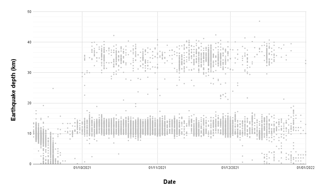
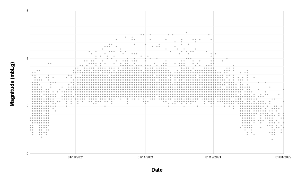
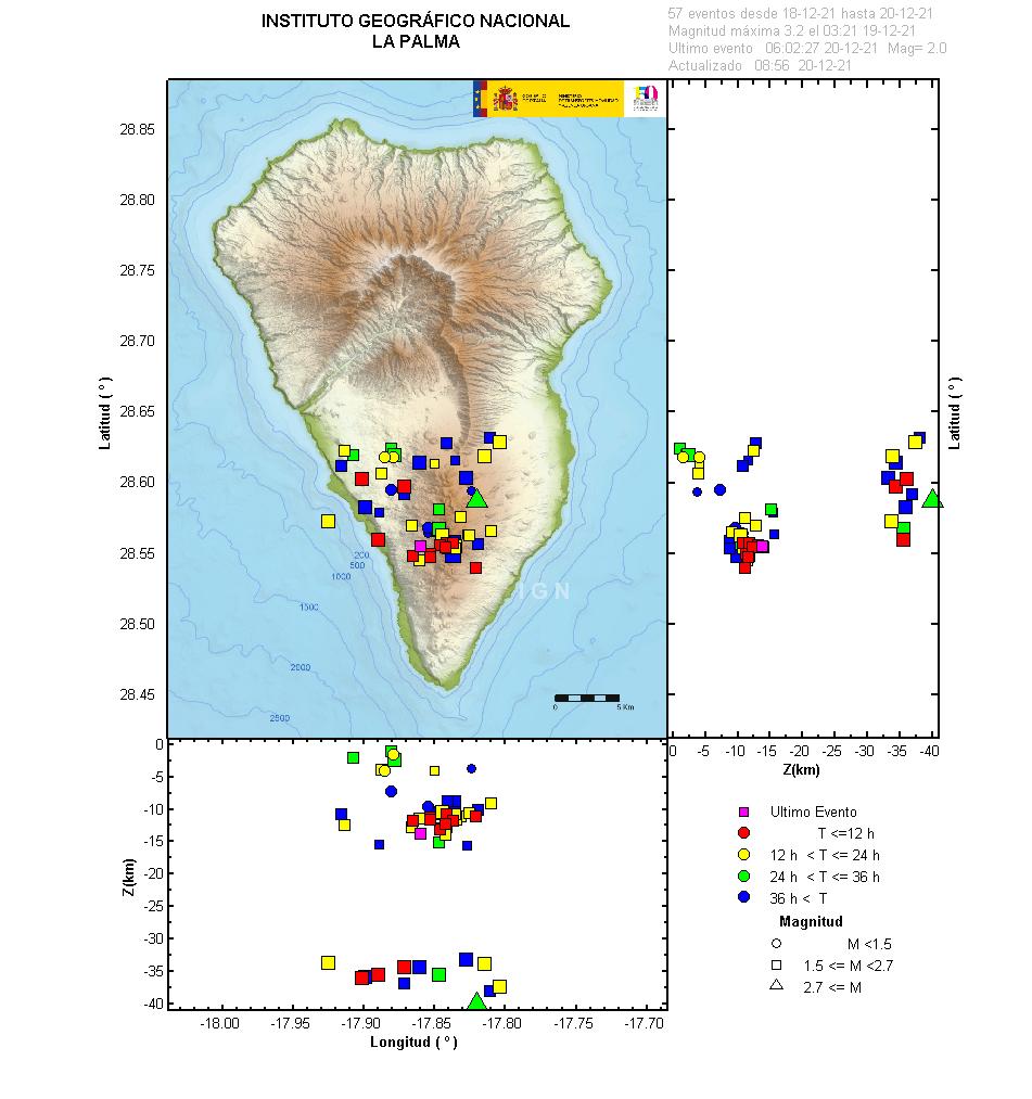
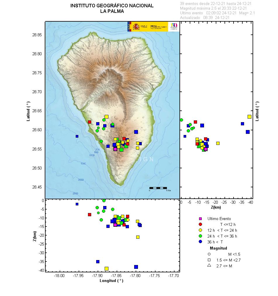
On the 19th of September, the volcano that would later be known as Tajogaite, erupted and changed the lives of many people living on the island of La Palma forever. The eruption went on to last 85 days and 8 hours and was announced to be over by Julio Perez on the 25th of December 2021. During the eruption two fissures opened up and multiple vents emitted 11 lava flows in total. The lava flows traveled westward eventually extending the coastline of the island. During the course of the eruption, six craters were formed, the total volume of lava erupted was 200 million cubic meters, lava covered 12.19 km2 of land, and 3,063 buildings were affected by the lava flows. For the residents living on the island, it was rare that an earthquake was not felt on an average day; throughout the eruption, 9,090 earthquakes were located, with 5.1 mbLg being the maximum magnitude recorded, and IV-V the highest intensity earthquake reached on the EMS scale. The graphs below portray the earthquake depth and magnitude recorded by IGN throughout the eruption.
Volcanic risk traffic light system is put in place to describe how the volcanological parameters will impact governmental response. The table below displays the system that was used during the Tajogaite eruption on La Palma.
| Colour | State | Volcanological parameters | Response |
|---|---|---|---|
| Green | Pre-Alert | Normal volcanological parameters | Population maintain their normal lives |
| Yellow | Alert | Increased volcanological signals such as seismicity, gas measurements, and ground deformation | Information to the population, surveillance measures and monitoring of volcanic and seismic activity are intensified |
| Orange | Maximum Alert | Volcanological parameters suggest an imminent eruption | Preventative evacuations and residents should make themselves available to authorities |
| Red | Emergency | Volcanic eruption is occuring and may pose significant risk to the population | Total evacuation of the population in affected areas |
Key events
See the simplified timeline of the key events of volcanic risk traffic light changes, confinement orders, evacuation orders, and eruption changes.
-

The Government activates PEVOLCA and changes the traffic light to yellow
Given the increase in seismic activity, the Government of the Canary Islands today convened the Scientific Committee of the Special Plan for Civil Protection and Attention to Emergencies due to Volcanic Risk (PEVOLCA) to assess the situation, agreeing to activate this Plan in a situation of Alert for Fuencaliente, Los Llanos de Aridane, El Paso and Mazo and the change of the traffic light from green to yellow for said municipalities.
-

The yellow traffic light maintained until the eruption began at 14:10 p.m.
The Steering Committee has decided to start evacuating, as a priority, people with reduced mobility, however, prior to the eruption starting the traffic light system remained yellow. At 14:10 hours (UTC) on September 19th 2021, the eruption begins on the island of La Palma in the area of Cabeza de Vaca, in the municipality of El Paso, after intense seismic and deformation activity registered since September 11th. he PEVOLCA steering committee briefly raised the Alert Level to Orange, and then to Red (the highest level on a four-color scale) by 1700.
-

PEVOLCA reports mass evacuation and increases the exclusion zone radius
Forty homes have been evicted and the number of evacuees stands at around 5,500 people, the Maritime Captaincy has extended the exclusion radius to 2 nautical miles, and the 2 km radius exclusion zone around the volcano is established.
-

The PEVOLCA evacuation plan transfers a further 160 people
PEVOLCA, after a warning of an increase in the intensity of the volcano that was reflected in a projection of larger pyroclasts, had first decided on confining residents but, due to the change in the situation, they proceeded to evacuate. In total, some 160 people have been evacuated, most of whom will spend this night in the homes of relatives or friends by their own decision, 12 at the Teneguía Princess hotel, in Fuencaliente, and another 10 with mobility problems who will be accommodated in the Quartering. Since the eruption began last Sunday, an estimated 6,000 people have been evacuated.
-

Some evicted residents return home
Geological indicators such as tremors, seismic signals and deformation are being observed at less elevated and more stable levels. PEVOLCA, based on the report of the Scientific Committee of the same morning, has agreed to the return of the residents evacuated last Friday from Tajuya, Tacande de Abajo and Tacande de Arriba, in the municipality of El Paso. This is approximately 160 people.
-

Concerns of exposure to acidic gases
While the eruption lasts on La Palma, the administration will maintain the current safety precautions “with the same intensity” deployed on the island. 5,600 people are still evacuated preventively. Confinement of some 300 residents of the coastal areas of the municipality of Tazacorte, specifically San Borondon, Marina Alta, Marina Baja, and La Condesa, given the risk that they could suffer exposure to hydrochloric acid gas.
-

PEVOLCA lifts the confinement order
PEVOLCA agreed to lift the confinement decreed last night in various areas of Los Llanos de Aridane and El Paso, as well as the stipulated one, on September 26, in the coastal towns of Tazacorte. This decision is adopted after registering favourable meteorological conditions that have allowed an improvement in air quality.
-

Temporary local confinement
Confinement of the population near the Callejón de la Gata industrial estate due to the emanation of gases that could be dangerous due to the combustion of materials,
-

Local temporary confinement ends and an evacuation elsewhere
PEVOLCA has agreed on the preventive evacuation of 700-800 people in new areas of La Laguna, in the municipality of Los Llanos de Aridane, given the advance of the lava towards proximity of the exclusion perimeter. This lava flow forced the confinement of the population near the Callejón de la Gata industrial estate yesterday, due to the emanation of gases that could be dangerous due to the combustion of materials, a measure that was lifted this morning once the lava overcame the area and air quality could be checked.
-

The northwest lava flow forces further evacuations
It was reported that the original lava flow and the appendages of that flow now surround the Todoque mountain but have stopped their advance. However, the northwest flow presents a greater hazard. Using hazard maps of the flows, the Plan Directorate ordered preventive evacuations last night and this morning in La Laguna.
-

Preventive confinement of neighborhoods in Tazacorte
The confinement measure affects some 3,000 people from San Borondón, Tazacorte and the disseminated area of El Cardón, up to the Camino Los Palomares in the north. The confinement order is taken in anticipation of possible emanations of gases that are harmful to people’s health due to the contact of the lava with the sea.
-

Confinement of Tazacorte neighborhoods ends
The PEVOLCA Directorate has finalized this noon the confinement order for the coastal areas Tazacorte decreed yesterday as a result of the arrival of lava flow 7 at La Viña beach. Since it has been confirmed that today there is no longer any risk to the population due to the emanation of gases when the lava comes into contact with the sea. This measure affected San Borondón, Tazacorte Casco and the Cardón spread to Camino Los Palomares in the north, although the population closest to the new lava delta is still recommended to wear an FFP2 mask.
-

Return of residents to Las Martelas
The residents of the area between Nicolás Brito País street and the Las Martelas de Abajo area, in the municipality of Los Lanos de Aridane, have been able to return to their homes this morning after the PEVOLCA Directorate ended. Gustavo Armas, gave an account of the progress of the construction of a jetty that allows the maritime connection between Puerto Naos and Tazacorte, as well as the execution of as many emergency works and procedures that are necessary for the reconstruction of various affected road sections.
-

No ash or pyroclast emission for the first time since the eruption began
PEVOLCA have said that the absence of eruption indicators, both directly on the surface and from surveillance systems, corroborates the signs of exhaustion of the eruptive process, but that in order to say that the eruptive process has ended, the recorded and observable data must be maintained at current levels for 10 days.
-

1000 people return home
During the meeting of the Steering Committee a document on the end of the evacuation of some areas and population centres of El Paso, Tazacorte, Los Llanos de Aridane and Fuencaliente was prepared. As well as the operations necessary for the relocation of approximately 1000 people from said areas, which will take carried out tomorrow, Monday, from 9:00 a.m.
-

PEVOLCA reduces the exclusion zone and allows more evacuated population to return
From Friday the 7th at 7:00 a.m., some residents can return to their homes: those with homes on the north side of the lava flow, those located between the coast and la Montaña, those located between la Montaña and La Laguna crossing including the La Aldea road, the houses located on the Baile Bueno road, the houses on the Cruz Chica road, the Los Campitos road; the homes on the Tamanca general highway (LP-2) and the homes on the San Nicolás highway (LP-212).
-

The volcanic risk traffic light changes from red to yellow
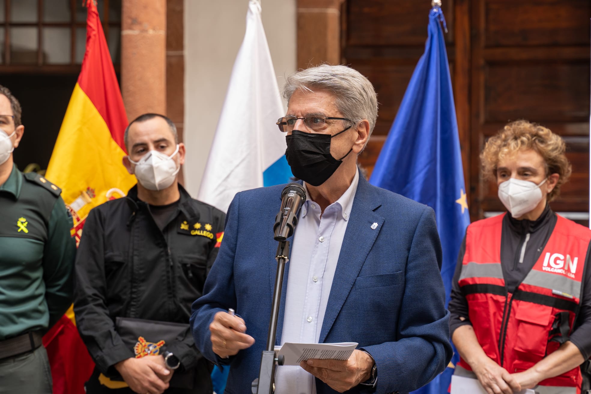
Julio Pérez has signed the order establishing the pass of the volcanic risk traffic light on the island of La Palma from red to yellow, with which the Insular Emergency Plan of La Palma (PEIN) remains in a level 1 emergency situation, PEVOLCA becomes an alert situation and the Cabildo assumes emergency management.
Timeline
To the full timeline of events, scroll from September reports through to the January reports. Alternatively, if you would like to sort by group, refer to the code system table below and select which group you would like to read more about.
| Groups | Description |
|---|---|
| General evaluation | General assessment of the situation. |
| Volcanic evaluation | Assessment exclusively of the volcanic activity. |
| Return of residents | Return of residents to previously evacuated area. |
| Evacuation | Evacuation of residents announced. |
| Confinement ON | Confinement of residents announced |
| Confinement OFF | Confinement of residents announced lifted. |
| Trafficlight | Traffic light system change. |
| Decision | Policy decisions made public excluding traffic light changes. |
| Past Decision | Past policy decisions maintained/reminding the public of decisions made |
| Recommendations | Recommendations made to the public. |
| Public event | Public communications e.g. town meeting. |
| Exclusion zone | Exclusion zone perimeter change. |
| VONA | Volcano Observatory Notice for Aviation issued by IGN when the change in ash plume height would impact aviation. |
| Seismic activity | IGN reported seismic activity on La Palma. |
| Plume height | IGN reported ash plume activity, this could be an increase or decrease in height or a change in the direction of the scattering cloud. |
| Volcanic tremor | IGN reported volcanic tremor activity. |
| Volcanic tremor intensification pulses | IGN reported intensification in the volcanic tremor signals. |
| Uplift | IGN reported that uplift was observed |
| Subsidence | IGN reported subsidence was observed. |
| Directional deformation | IGN reported deformation with a directional element was observed. |
| Deformation | IGN reported deformation without direction. |
| Eruption increases | IGN reported the eruption of pyroclastic materials had started or increased. |
| Eruption decreases | IGN reported the eruption of pyroclastic materials ended or decreased. |
| Lava flow activity | IGN reported on the lava flow activity. |
| Ash emission activity | IGN reported on ash emission from the volcano. |
| Reversal of deformation | IGN reported a reversal of deformation previously reported. |
| Volcanic cone measurement | IGN reported a volcanic cone height measurment |
| Earthquakes felt | IGN reported that earthquakes were felt by a population. |
| Degassing | IGN reported that volcanic degassing was observed. |
| Official statement | Statement from the Canarian Government. |
| Geological report | IGN report on various geological and volcanological activity occuring. |
- Geological report
- Official statement
- Ash emission activity
- Deformation
- Degassing
- Directional deformation
- Earthquakes felt
- Eruption decreases
- Eruption increases
- Lava flow activity
- Plume height
- Reversal of deformation
- Seismic activity
- Subsidence
- Uplift
- Volcanic cone measurement
- Volcanic tremor
- Volcanic tremor intensification pulses
- Confinement OFF
- Confinement ON
- Decision
- Evacuation
- Exclusion zone
- General evaluation
- Past Decision
- Public event
- Recommendations
- Resident return
- Trafficlight
- Volcanic evaluation
- VONA
- Tajogaite timeline

Timeline data accumulated by Ajay Jones and Ryan Bailey

