04 Jan La Palma eruption – 4th January 2022
La Palma eruption – 4th January 2022
Daily summary
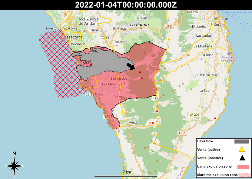
PEVOLCA is investigating the possibility of allowing further returns of evacuated people as soon as next Friday, as it continues to analyse the state of the lava flows. The lava flows are mainly being analysed in terms of their temperature, stability and gas emissions, with the adjustment of the exclusion area being possible if results are favourable. The areas around Puerto Naos, El Remo and La Bombilla in the south, which have had greatest issues from gases from the lava flows, will be studied in the coming days. In the areas not safe to return, the current civil protection restrictions remain in place, as does the legal emergency and the red volcanic alert traffic light.
In regard to volcanic parameters, an uptick on the tremor graphs was noted, although IGN seismologists have stated the signal is not due to volcanic tremor but have yet to give an explanation of the source of the signal. Elsewhere, earthquakes and deformation remain near or at background levels, and the SO2 emissions from the cone are described as low and are due to gases escaping as the solid magma beneath the surface cools and contracts. PM10 and SO2 concentrations remain reasonably good to good across all stations, and good across all stations, respectively.
Finally, new estimates of the volume of material released by the volcano have been made; the main cone is said to be 28 million m3, whilst the subaerial lava field is approximately 187 million m3. These volumes however don’t take into account the volume of underwater lavas and the fallen ash further away from the volcano.
Sources: IGN Spain, Cabildo De La Palma, Gobiernode Canarias, DSN, PEVOLCA
News articles
-
- Canary Island Government – PEVOLCA moves to advance relocations – here
- El Time – Probability of a future eruption on La Palma – here
- El Time – Money for affected businesses – here
- El Time – Social meeting with Tazacorte farmers about access – here
To see our full news archive, visit our open data section or click here.
Photography
- Access photography taken around this time
- IGME – Drone photography of the volcanic vents post eruption – here
Environment maps
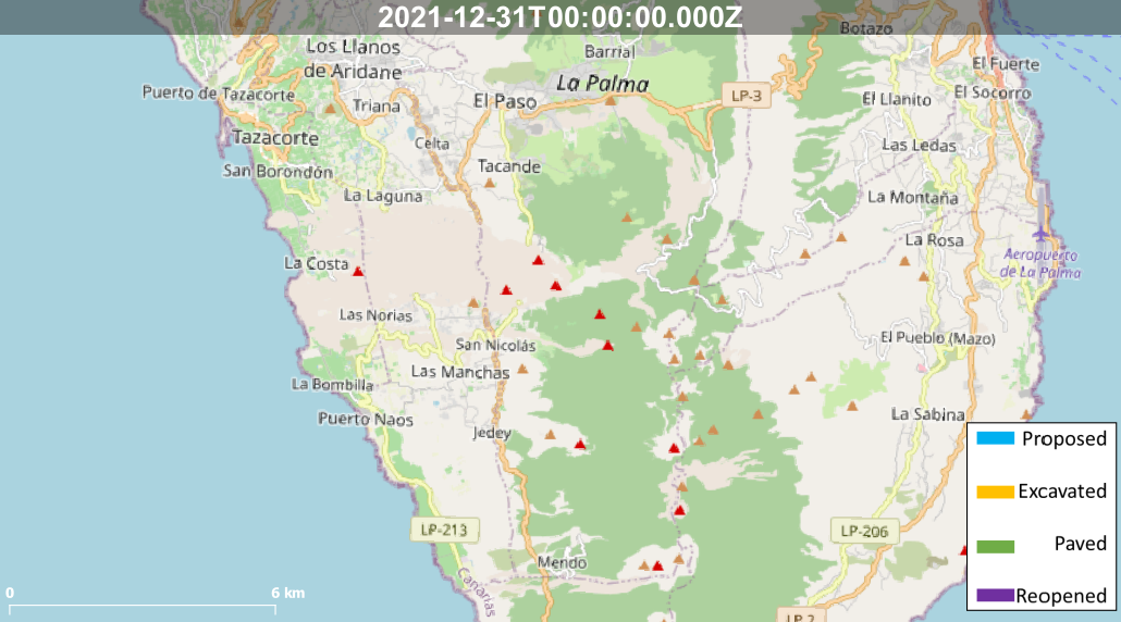
The exclusion zones and road construction plans shown here have been approximated from press releases from the Cabildo de La Palma and will not be exact, nor claim to be official maps of the exclusion zones and road construction. For official information, please contact the Cabildo de La Palma.


News and Interviews
Access our archive of news articles here.
Interactive Road construction map
Come back soon to access this map.

No Comments