29 Nov La Palma eruption update 29th November 2021: Limited activity seen in the main cone
La Palma eruption – 29th November 2021
Daily summary
Activity from the summit of the central cone has been minimal today, contrasting with previous days where weak strombolian and phreatomagmatic activity was observed. The lower Hawaiian vents at the base of the northeastern flank that opened in the early hours of the 28th November continue to produce a large but decreased quantity of lava relative to yesterday. These feed a new lava flow covering new land near the northern margin of the current lava field, in the direction of La Laguna. However, the flow is slower and more viscous today, and it is expected to join flow number 8 (the flow nearest the centre of La Laguna) or stop, depending on the evolution of the activity from the feeding vents.
Seismicity was elevated for the second day in a row today relative to last week, with about 90% of the earthquakes again being concentrated at 10-15 km depth. The largest earthquake however was a M5.0 at 35 km depth at 08:35 this morning. Concerning air quality, which reached ‘very unfavourable’ levels yesterday in Los Llanos De Aridane, Tazacorte and El Paso, the SO2 and PM10 levels were better today. SO2 was ‘regular’ in Los Llanos De Aridane and Puntagorda, but was ‘good’ or ‘reasonably good’ in all other areas, and PM10 levels were at least ‘reasonably good’ at all stations. Deformation is stable and shows no significant changes, as are CO2 emissions, and the column height was relatively low at 1400 m, dispersing to the S-SW.
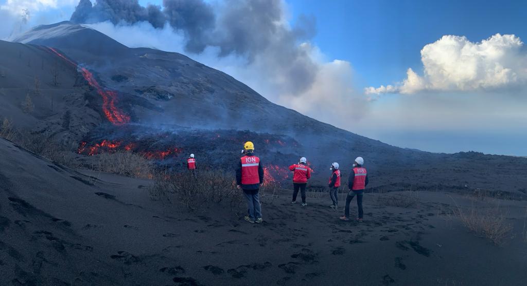
A team of volcanologists observe the new lava flow to the north of the current lava flow field, originating from the new vents on the NE flanks of the main cone. Image credit: IGN
Sources: Government of the Canary Islands, PEVOLCA, Involcan, IGN, DSN, Cabildo La Palma, 112 Canarias, Tolouse VAAC, Copernicus EMS
Lava flows

Earthquakes

Exclusion zone map
Exclusion zones shown here have been approximated from press releases from the Cabildo de La Palma and will not be exact, nor claim to be official maps of the exclusion zones. For official information, please contact the Cabildo de La Palma.

Official social media
To see our full social media archive, visit our open data section or click here.
News articles
- El Pais – New vents and longest eruption – here
- BBC News – New vent opens – here
- Daily Mail – Six new vents tear open on La Palma – here
- El Dia – New land covered by lava – here
- El Pais – Booming lottery sales in La Palma due to the eruption – here
To see our full news archive, visit our open data section or click here.
Found a broken web link? We have archived all of our news articles on the WayBack Machine. You can view the pages by 1. pasting the broken link into WayBack Machine and clicking ‘Browse History’ 2. clicking on the latest capture date and then 3. clicking ‘view capture’. Please let us know of any broken web links by contacting us at enquiries@geotenerife.com.
Eruption footage
News and Interviews
Witness Testimonies
Interactive Lava Flow Map
Notes: Use the button in the top right to open the map into full screen mode. Use the legend icon in the top left to see the legend and further information about the map. Click on individual days to see an outline of the lava flows on that day.
Interactive Earthquake Map
click here to enlarge
Notes: The size of the points represents the size of the earthquake, and the colour represents the depth. The map will also only show a certain number of points at once. For ease of use, we recommend you uncheck all dates and the satellite basemap from the legend in the top right, and inspect the earthquakes one day at a time.
Sorry, the comment form is closed at this time.