09 Oct La Palma eruption update 9th october 2021: Partial cone collapse creates two new lava streams
La Palma eruption update 9th october 2021: Partial cone collapse creates two new lava streams
Daily summary
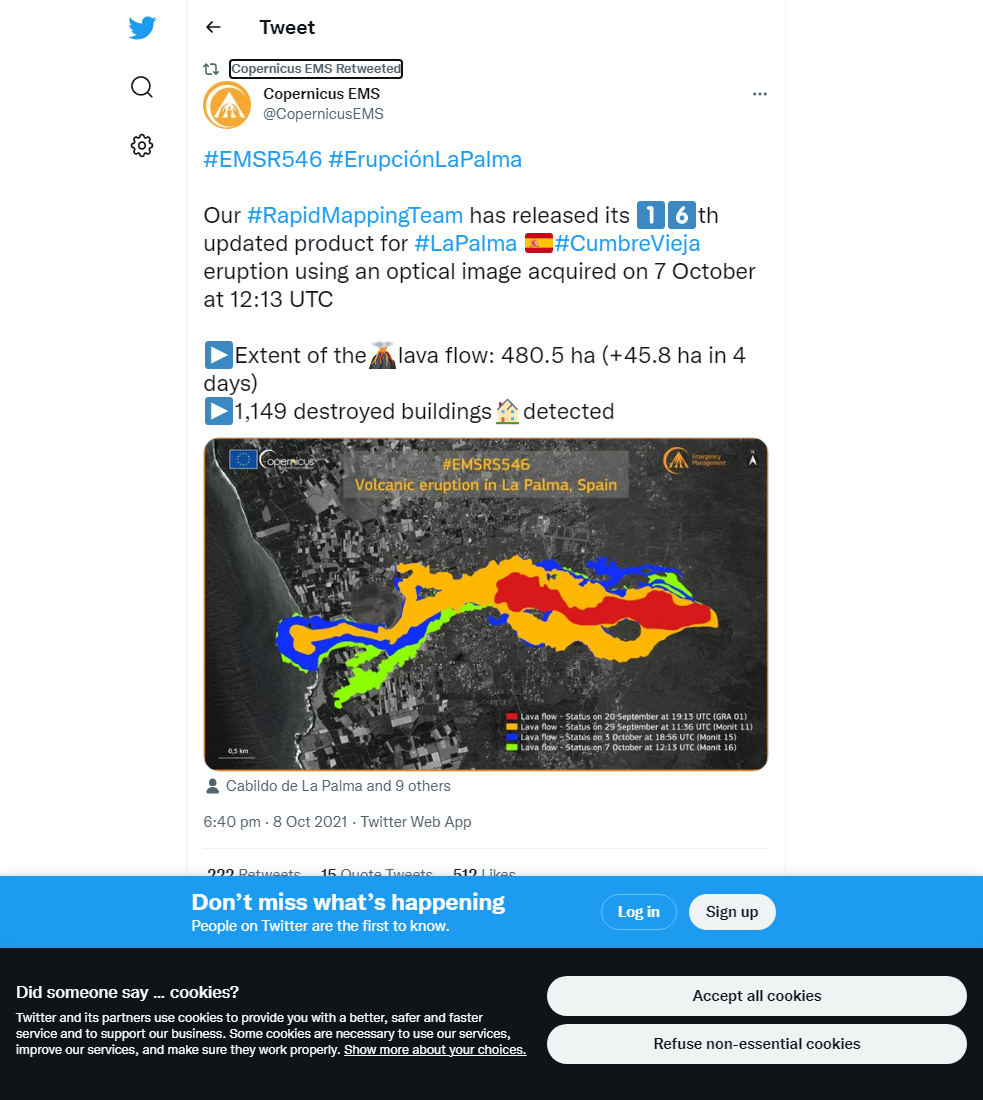
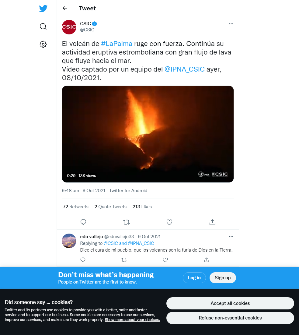
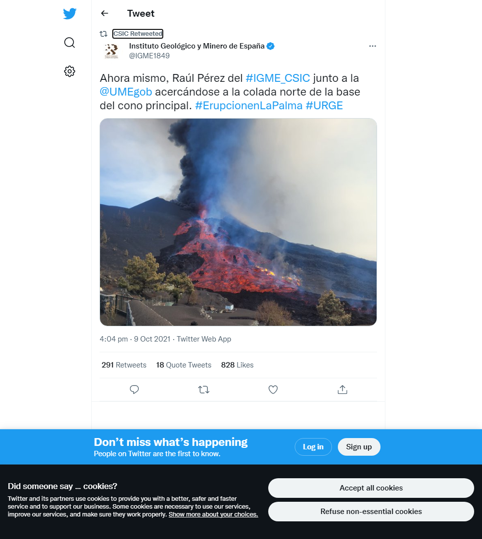
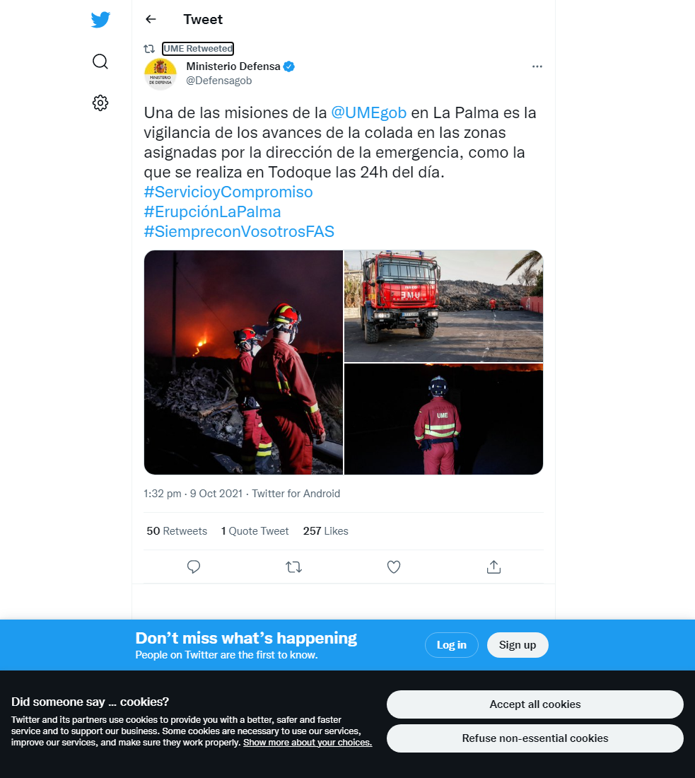
In the night between the 8th-9th, a partial collapse of the wall of the main cone caused a significant outpouring of lava as well as large blocks involved in the collapse. The outpouring created two new fluid lava streams, one travelling more to the north of the flow field and one further to the south, but both decreased in strength during the morning. The more southern flow especially is being monitored as it is contributing to the filling of a pronounced gully that, if completely filled, a breakout onto previously unaffected land could occur. It was commented that the partial collapse and subsequent change in morphology of the cone is a natural and repeated part of the eruptive process. Elsewhere, the new flow near the coast has still yet to reach the sea, and the lava delta is thought to have reached its maximum distance away from the cliffs, because it was reached the edge of the wave-cut platform. It continues to grow laterally along the coastline and has reached an area of 32 hectares.
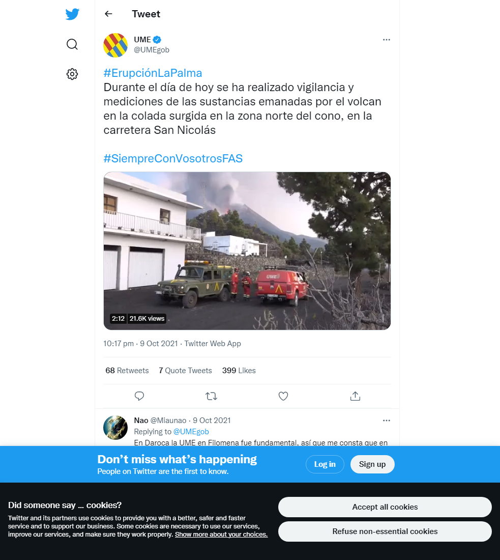
SO2 and PM10 concentrations improved throughout the day, consistent with more favourable atmospheric conditions. SO2 concentrations remained low at all stations, and PM10 concentrations did not exceed the daily threshold at any of the stations. For other eruption parameters, volcanic tremor is average and quite stable, with very infrequent peaks in amplitude. Deformation remains stable, with no significant trends being seen in the stations close to the eruption site. Earthquake activity has increased and is concentrated in the same areas at 10-15 km depth, although there have been some deep (20-40 km) earthquakes reported as well of greater magnitudes. 154 events were recorded, peaking at 3.9 mbLg. The ash and gas plume reached, 3500 m, and the SO2 emissions from the volcano were 4,522 tons per day, although this is an underestimate.
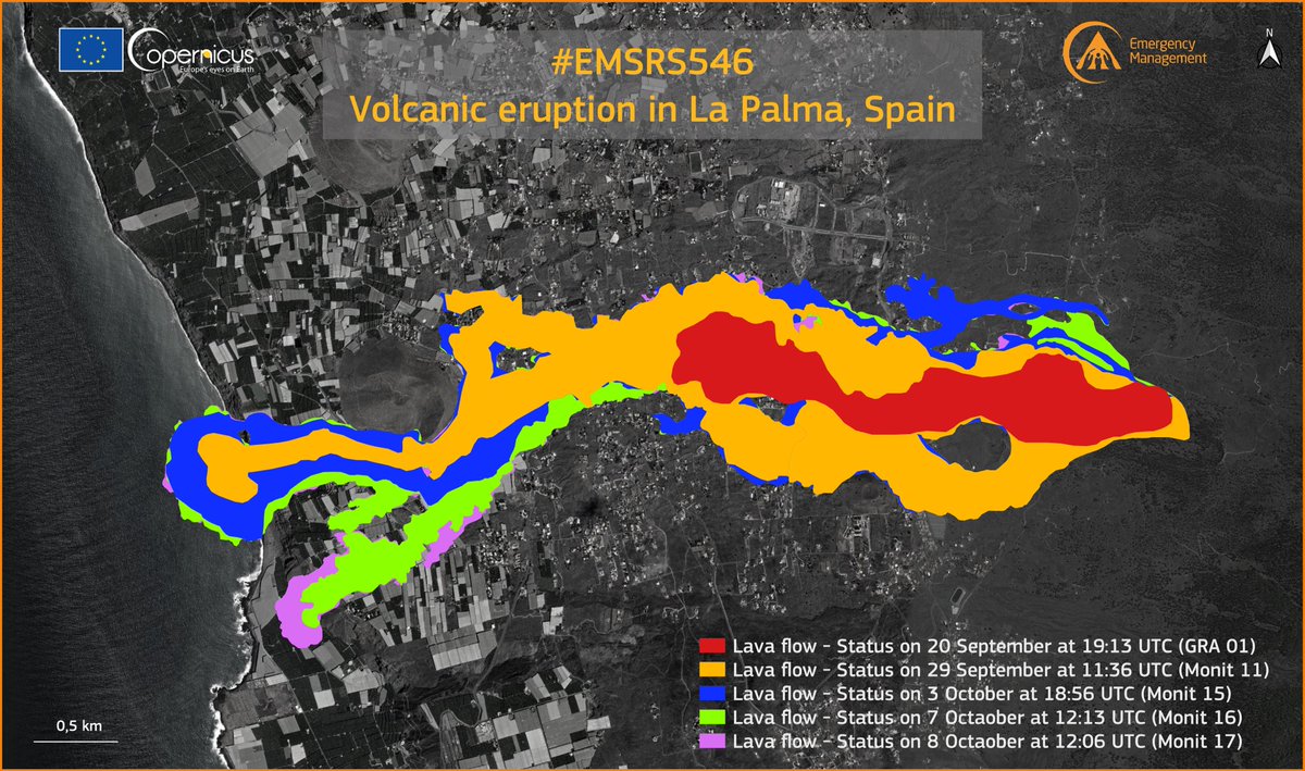
The latest map of the extent of the lava flows as of the 8th October. This map does not include the two new streams that started on the 9th after the partial cone collapse. Image credit: Copernicus EMS
Sources: Government of the Canary Islands, PEVOLCA, Involcan, IGN, DSN, Cabildo La Palma, 112 Canarias, Tolouse VAAC, Copernicus EMS
Lava flows

Earthquakes

Exclusion zone map
Exclusion zones shown here have been approximated from press releases from the Cabildo de La Palma and will not be exact, nor claim to be official maps of the exclusion zones. For official information, please contact the Cabildo de La Palma.

Official social media


To see our full social media archive, visit our open data section or click here.
News articles
- NASA Earth Observatory – Eruption continues at La Palma – here
- Al Jazeera – Spain: La Palma volcanic eruption intensifies, engulfs more homes – here
To see our full news archive, visit our open data section or click here.
Found a broken web link? We have archived all of our news articles on the WayBack Machine. You can view the pages by 1. pasting the broken link into WayBack Machine and clicking ‘Browse History’ 2. clicking on the latest capture date and then 3. clicking ‘view capture’. Please let us know of any broken web links by contacting us at enquiries@geotenerife.com.
Eruption footage
News and Interviews
Witness Testimonies
Interactive Lava Flow Map
Notes: Use the button in the top right to open the map into full screen mode. Use the legend icon in the top left to see the legend and further information about the map. Click on individual days to see an outline of the lava flows on that day.
Interactive Earthquake Map
click here to enlarge
Notes: The size of the points represents the size of the earthquake, and the colour represents the depth. The map will also only show a certain number of points at once. For ease of use, we recommend you uncheck all dates and the satellite basemap from the legend in the top right, and inspect the earthquakes one day at a time.
Sorry, the comment form is closed at this time.