12 Sep La Palma update 12th September 2021: New seismic swarm continues
La Palma update 12th September 2021: New seismic swarm continues
Daily summary
The new earthquake swarm on the south of La Palma has continued and today significantly intensified, both in the frequency and magnitude of the earthquakes. There were 208 earthquakes from 7-18 km depths, with the vast majority between 9-12 km depth. The largest event so far was a mbLg 3.4 earthquake and 9 km depth. This new seismic swarm is the first that has been detected since earthquake swarms in June and January 2021, which were largely clustered in similar areas but at depths deeper than 20 km. The swarm represents the 9th seismic swarm in southern La Palma since anomalous seismic activity began in the area in October 2017, which is thought to be related to magmatic reactivation of Cumbre Vieja. The shallow depth of these latest earthquakes as well as the increasing intensities are the most important aspects of this swarm thus far. Although the possibility or timescales of magmatic reactivation cannot be predicted, the likelihood of changes would increase if the swarm became shallower and more intense. Nonetheless, previous eruptions in the Canary Islands, including the 2011 El Hierro eruption were preceded by lengthy periods of strong seismicity at similar depths.
Source: Instituto Geográfico Nacional (IGN)
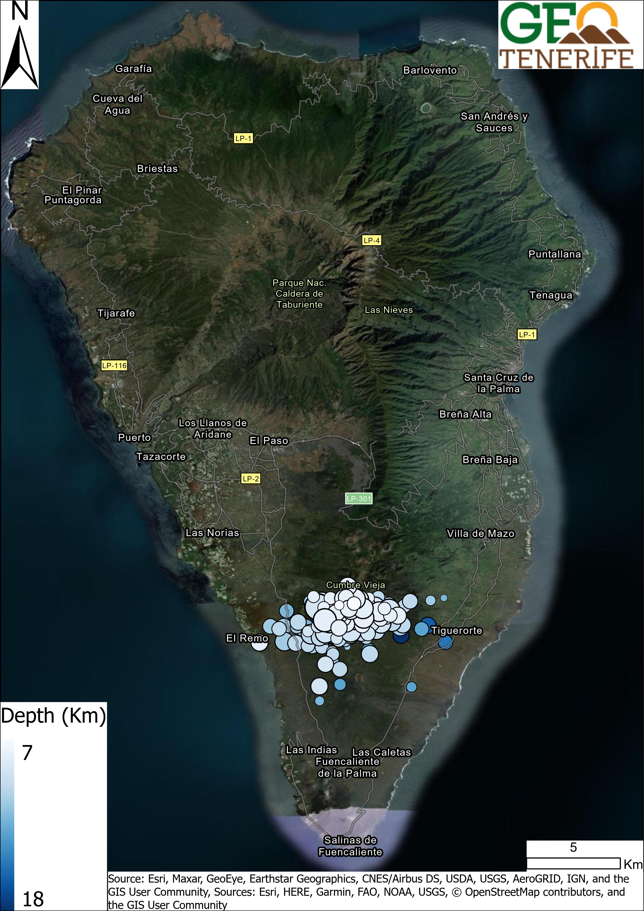
The earthquakes recorded on La Palma on the 12th September by IGN. The size of the dots indicate the relative sizes of the earthquakes
Earthquakes

Official social media


To see our full social media archive, visit our open data section or click here.
News and Interviews
Witness Testimonies
Interactive Lava Flow Map
Notes: Use the button in the top right to open the map into full screen mode. Use the legend icon in the top left to see the legend and further information about the map. Click on individual days to see an outline of the lava flows on that day.
Interactive Earthquake Map
click here to enlarge
Notes: The size of the points represents the size of the earthquake, and the colour represents the depth. The map will also only show a certain number of points at once. For ease of use, we recommend you uncheck all dates and the satellite basemap from the legend in the top right, and inspect the earthquakes one day at a time.
Sorry, the comment form is closed at this time.