Introduction
The Canary Islands have had a lot of volcanic activity over millions of years, and some of the islands are still active today; therefore, there will likely be another eruption at some point, but it is near-impossible to predict exactly when, where, or how big it will be. Scientists closely watch the volcanoes to understand their normal “background” activity so that they can identify when unusual volcanic behaviour might indicate that an eruption could be on the way. On this page we describe who monitors volcanic activity and participates in emergency response with a timeline of the main episode of unrest in the last 20 years.
It is important to refer to official sites for information in an emergency. The main sites to find information around volcanic unrest are:
Twitter accounts of the Islands’ Cabildos:
Cabildo de Lanzarote
Cabildo de El Hierro
Cabildo de La Palma
Cabildo de Tenerife
Other groups also cover volcanic unrest:
Current status of each island
VTL - Current volcanic traffic level by Ajay Geotenerife
For an explanation of Traffic Light System, click here
The colours in this interactive map do NOT correspond to the Volcanic traffic level above. The most recent earthquake is within the flashing red circle. Yellow circles are earthquakes with a magnitude less than 2, orange between 2-3, red between 3-4, and dark red is a magnitude of more than 4. IGN Spain uses the mbLg, which measures the body wave magnitude, uses a logarithmic scale, and this scale is suited for measuring earthquakes close to their epicentre.
Most recent report
A summarised version of the most recent report available through the IGN seismic catalogue, relevant social media, and news articles. You can find a comprehensive timeline at the bottom of this page.

Timeline of volcanic unrest
Drag the timeline along to see previous updates

3.3 mbLg earthquake 65 km north of Tenerife
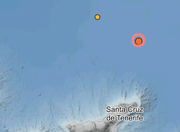
🇬🇧 🇺🇸 At 07:44 am local time, IGN detected a 3.3 mbLg earthquake 75 km north of Santa Cruz, Tenerife. The earthquake occurred at a depth of 47 km. This follows an earthquake of 2.9 mbLg which occurred yesterday 110 km North of Santa Cruz, 5th February 2025, at 03:51 am at a depth of 75 km into the earth.
🇪🇸 🇮🇨A las 07:44 a. m., hora local, IGN detectó un terremoto de 3,3 mbLg a 75 km al norte de Santa Cruz, Tenerife. El terremoto se produjo a una profundidad de 47 km. Esto sigue a un terremoto de 2,9 mbLg que ocurrió ayer 110 km al norte de Santa Cruz, el 5 de febrero de 2025, a las 03:51 a. m. a una profundidad de 75 km en la tierra.
PEVOLCA scientists agree on the “anomalous” activity of Teide, although there are no signs of an eruption
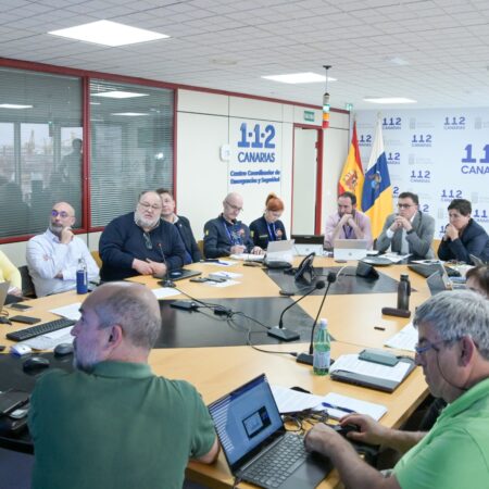
🇬🇧 🇺🇸 Experts from the Scientific Committee for the Evaluation and Monitoring of Volcanic Phenomena (CCES), provided for in the Special Plan for Civil Protection and Emergency Response due to volcanic risk in the Autonomous Community of the Canary Islands (PEVOLCA), agree in describing the volcanic activity of Teide as “anomalous”, although the signs “do not seem to be precursors of an eruptive process in the short term, but they do imply an increase in the probability of it occurring in the medium to long term”. (Gobierno de Canarias, 2025)
🇪🇸 🇮🇨 Los expertos del Comité Científico de Evaluación y Seguimiento de Fenómenos Volcánicos (CCES), previsto en el Plan Especial de Protección Civil y Atención de Emergencias por riesgo volcánico en la Comunidad Autónoma de Canarias (PEVOLCA), coinciden en calificar como “anómala” la actividad volcánica del Teide, aunque los indicios “no parecen ser precursores de un proceso eruptivo a corto plazo, pero sí suponen un aumento en la probabilidad de que se produzca a medio largo plazo”. (Gobierno de Canarias, 2025)
Seismic swarm in Las Cañadas del Teide
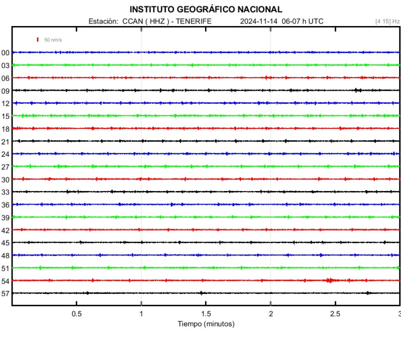
🇬🇧 🇺🇸 On 14 November 2024, more than 500 earthquakes were detected in the Cañadas del Teide, southwest of Pico Viejo, in the same area where seismicity has been recorded in recent years (October 2016, June 2019 and June and July 2022). There were also additional earthquakes that were too small (low magnitude) to be located (IGN, 2024).
🇪🇸 🇮🇨 El 14 de noviembre de 2024 se detectaron más de 500 terremotos en las Cañadas del Teide, al suroeste de Pico Viejo, en la misma zona donde se ha registrado sismicidad en los últimos años (octubre de 2016, junio de 2019 y junio y julio de 2022). También se produjeron otros terremotos que fueron demasiado pequeños (baja magnitud) para ser localizados (IGN, 2024).
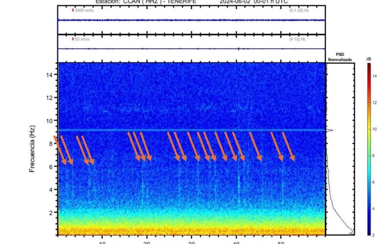
Detection of low-frequency signals in the interior of Tenerife