07 Oct La Palma eruption update 7th october 2021: Earthquake activity intensifies
La Palma eruption update 7th october 2021: Earthquake activity intensifies
Daily summary
A relatively stable period in the eruption continues, both in respect to the paths taken by the lava flows and the surface eruptive activity. Between the 5th and 6th, the area affected by the lava flow only increased by 9 hectares, now totalling 431.2 hectares, and the maximum width of the flow field remains the same at 1,250 m. However, 350 m from the coast, a small lava breakout has occurred, creating a new flow that has cascaded down cliffs north of the current lava delta onto an area of low topography that is part of the lava delta formed in the 1949 eruption, although it has not yet reached the sea. Throughout the morning earthquake activity has intensified although continues to be concentrated at 10-15 km depth in the area of the precursory swarm. 99 earthquakes were recorded, the largest being 4.3 mbLg which was felt across the island. PEVOLCA commented that a similar intensification in seismic activity was seen in the 2011 El Hierro eruption after the eruption had begun.
As expected, a reduction in the height of the thermal inversion has led to a decrease in air quality across particularly the western half of the island. With respect to SO2 concentrations, the air quality decreased to ‘regular’ levels through the night of the 6th-7th, and decreased further throughout the day. The hourly SO2 threshold of 350 μg/m3 was exceeded 5 times in El Paso, 2 times in Los Llanos and 1 time in Tazacorte, with peak concentrations of 667 μg/m3, 364 μg/m3 and 368 μg/m3 in these stations respectively. PM10 concentrations however only exceeded the daily threshold (50 μg/m3) in Los Llanos. The SO2 emissions from the volcano were estimated at 4,994 tons per day, although it is commented that this is an underestimate.
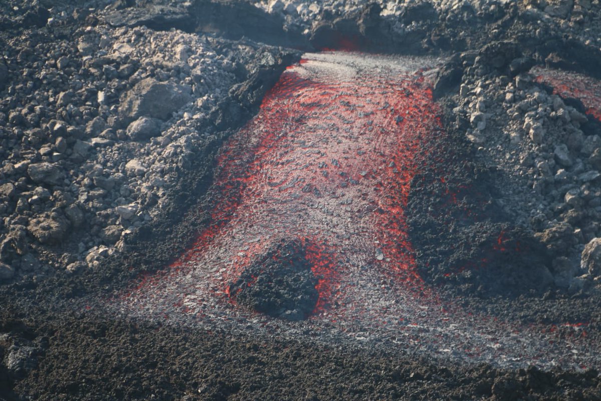
A breakout of lava from a lava tube feeding the lava delta. Image credit: INVOLCAN
Sources: Government of the Canary Islands, PEVOLCA, Involcan, IGN, DSN, Cabildo La Palma, 112 Canarias, Tolouse VAAC, Copernicus EMS
Lava flows

Earthquakes

Exclusion zone map
Exclusion zones shown here have been approximated from press releases from the Cabildo de La Palma and will not be exact, nor claim to be official maps of the exclusion zones. For official information, please contact the Cabildo de La Palma.

Official social media
To see our full social media archive, visit our open data section or click here.
News articles
- Daily Express – La Palma earthquake sparks fears volcano eruption will get WORSE as new lava flow opens up – here
- Reuters – Volcanic ash shuts La Palma airport – here
To see our full news archive, visit our open data section or click here.
Found a broken web link? We have archived all of our news articles on the WayBack Machine. You can view the pages by 1. pasting the broken link into WayBack Machine and clicking ‘Browse History’ 2. clicking on the latest capture date and then 3. clicking ‘view capture’. Please let us know of any broken web links by contacting us at enquiries@geotenerife.com.
Eruption footage
News and Interviews
Witness Testimonies
Interactive Lava Flow Map
Notes: Use the button in the top right to open the map into full screen mode. Use the legend icon in the top left to see the legend and further information about the map. Click on individual days to see an outline of the lava flows on that day.
Interactive Earthquake Map
click here to enlarge
Notes: The size of the points represents the size of the earthquake, and the colour represents the depth. The map will also only show a certain number of points at once. For ease of use, we recommend you uncheck all dates and the satellite basemap from the legend in the top right, and inspect the earthquakes one day at a time.
Sorry, the comment form is closed at this time.