19 Dec Seismic activity moves westward
Seismic activity moves westward
Yellow traffic light
Pre-eruptive seismic activity prompts the yellow traffic light and evacuations
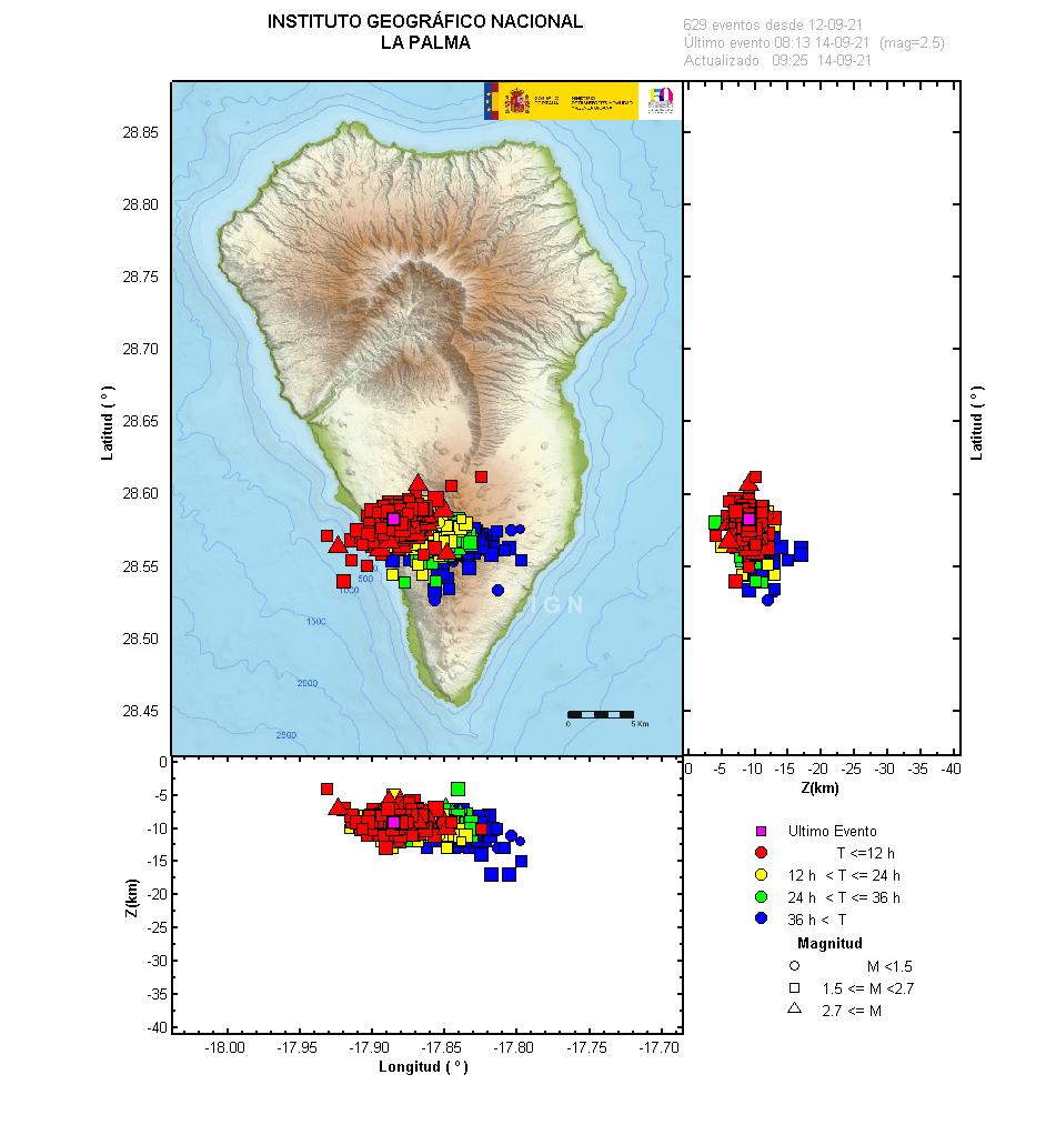
The seismic activity appears to be moving westward and its depth has decreased. The surface deformation has reached 1.5 cm and shows a distribution compatible with the location of the seismicity. From the 13th of Sep, until 8:00 (UTC) today, 1365 earthquakes have been detected in the southern area of the island of La Palma, of which 61 have been located. The largest earthquake occurred today at 06:00 (UTC) with a provisional magnitude of 3.9 mbLg. The depth of earthquakes at this time is between 8 and 10 km. In the last few hours, the seismicity apparently has had a slight migration towards the west of the island. Surface deformation is also observed, both in the island’s network of GNSS stations and in the inclinometer. On the other hand, the GNSS network has registered an accumulated deformation since the beginning of the seismic series of 1.5 centimetres (IGN, 2021).


Sorry, the comment form is closed at this time.