Most recent
¿Por qué vuelve la gente?
Un estudio reciente aporta pruebas de que algunos habitantes locales regresaron rápidamente a Pompeya tras la erupción del Vesubio del año 79 d. C., que, como es bien sabido, sepultó la ciudad romana bajo violentos flujos piroclásticos. Estos hallazgos suscitaron una considerable cobertura mediática, y muchos se preguntaron por qué la gente volvería a la zona destruida. Sin embargo, esto no es la excepción, sino más bien la regla para cualquiera que esté familiarizado con las llamadas
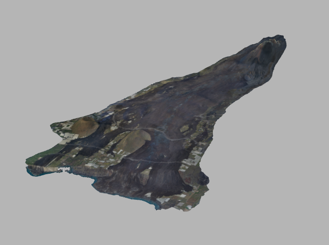
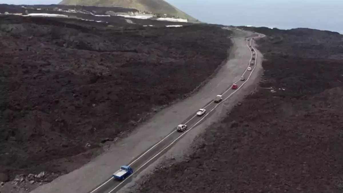
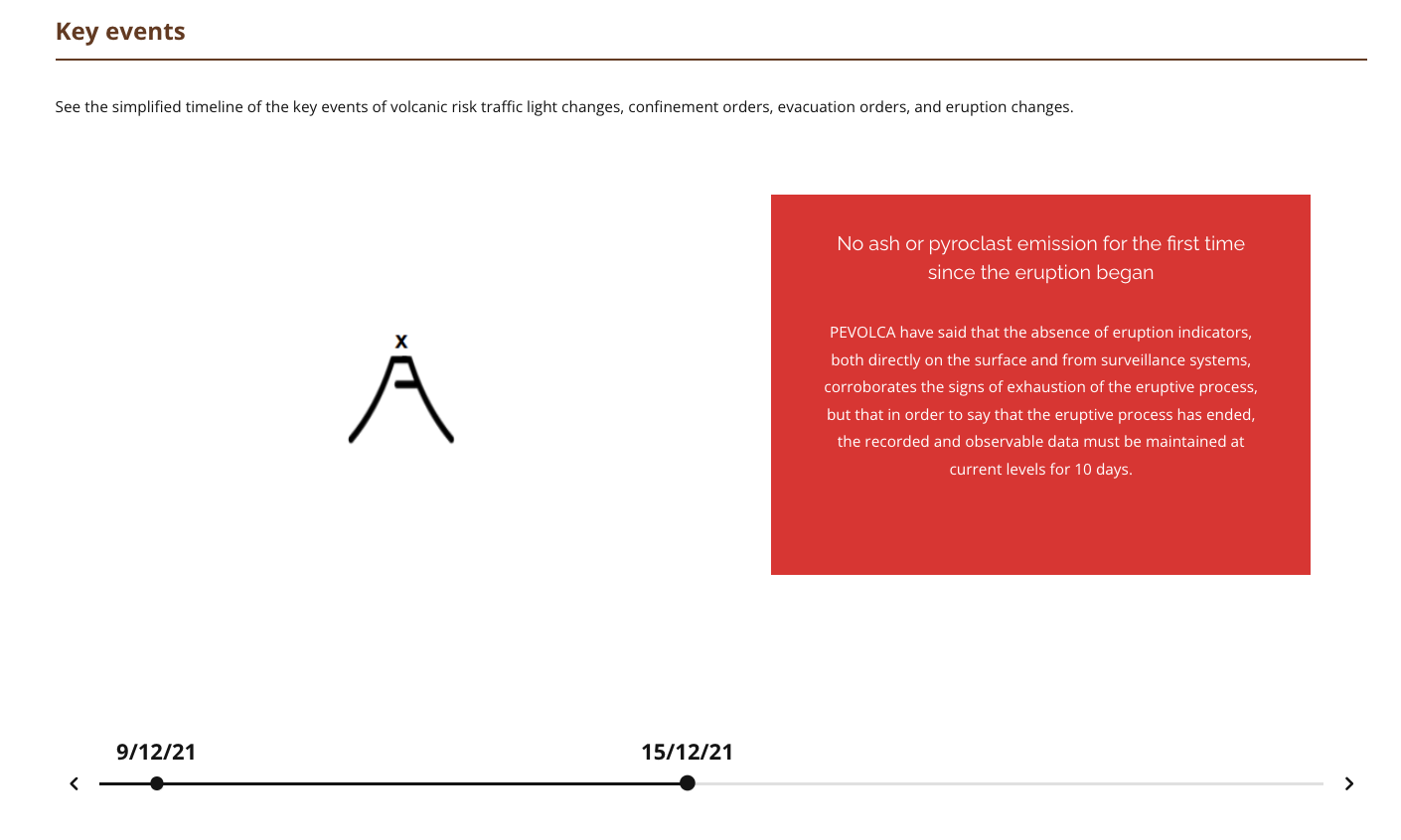
Volcán de Tajogaite (2021) Eruption and Reconstruction
Charities to support affected residents
Here are the charity campaigns we have supported/run for the affected residents of the La Palma eruption
Forum Navigation
VolcanoStories Forum
VolcanoStoriesLast post
Q+A about Sustainable TourismAsk the Researchers, Editors, and Collaborating experts of VolcanoStories Sustainable Tourism project about our work in the Canary Islands0 Topics · 0 PostsNo topics yet!
No topics yet!
Q+A about Volcanic ReadinessAsk the Researchers, Editors, and Collaborating experts of VolcanoStories Volcanic Readiness project about our work in the Canary Islands1 Topic · 2 PostsLast post: Resiliencia volcánica · 5 months ago · GeoTenerife
Q+A about La Palma's reconstructionAsk the Researchers, Editors, and Collaborating experts of VolcanoStories La Palma project about our work in La Palma post eruption.2 Topics · 4 PostsLast post: ¿Por qué la información solo se pu … · 8 months ago · GeoTenerife
LAVA BOMBS SeriesA space for any questions, discussion, and debate regarding the themes of the two LAVA BOMBS series.0 Topics · 0 PostsNo topics yet!
No topics yet!
Any other questions ?This is a space for any other questions you have about GeoTenerife's work0 Topics · 0 PostsNo topics yet!
No topics yet!
Q+A about volcanic unrestQuestions about current or previous volcanic unrest in the Canary Islands6 Topics · 12 PostsLast post: Are IGN, Involcán and the Presiden … · 8 months ago · GeoTenerife
La ConversaciónUn espacio para que los residentes comenten o hagan preguntas sobre nuestros artículos de opinión.5 Topics · 5 PostsLast post: La conversación: ¿Por qué vuelve l … · 2 weeks ago · GeoTenerife
The ConversationA space for residents to comment, ask questions, and engage with the subject of about our opinion pieces6 Topics · 6 PostsLast post: The Conversation: People returned … · 3 weeks ago · GeoTenerife
Statistics
20
Topics
29
Posts
21,221
Views
123
Users