🇪🇸¿Quieres leer la página de Historias de Volcanes en español?🇮🇨
Puedes usar la función de traducción automática de Google Chrome
🇪🇸¿Quieres leer la página de Historias de Volcanes en español?🇮🇨
Puedes usar la función de traducción automática de Google Chrome

Volcanic risk, emergency plans, communication, and preparedness in the Canary Islands.
Short-form , easy-to-read, articles, which are relevant to the residents of the Canary Islands. Available en Español and in English.
En los años transcurridos desde la erupción de Tajogaite en La Palma en 2021, los vulcanólogos han publicado investigaciones que identifican señales precursoras tanto del inicio como del final de la erupción a partir de diversas fuentes de datos. Un estudio reciente ha demostrado incluso que la
In the years since the 2021 Tajogaite eruption on La Palma, volcanologists have published research identifying precursory signals for both the beginning and end of the eruption from a variety of different data sources. One recent study has even shown evidence that the reactivation of La Palma’s ma
Frustrated by unchecked development and environmental degradation, 200,000 Canarians protested in April and several thousand again in October 2023, demanding a more sustainable tourism model that prioritises local needs and protects the islands’ fragile ecosystem. A third large-scale protest is being organised for May 2025 which we will be covering here on Urgent events.

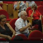
After #20A, the Canary Islands Parliament voted on 24 April on the impacts of the mass-tourism model on the economy, environment and society. Only one of the proposals was approved (to ‘promote limitations on numbers and fees for non-residents to access protected natural areas, an ‘eco-tax’) a
New study on failures of 'Neoliberal' reconstruction model in La Palma - 'Lava Bombs' documentary shown at Mt. Etna Observatory - Debates over €100 million from Spain for 2024 and the 60% income tax reduction in La Palma - Difficulties in reconstructing the LP-2 and LP-211 roads - 34 houses planne
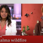
GeoTenerife in roundtable TV discussion about Lava Bombs documentary – Debates over the 60% income tax reduction on La Palma - €100 million from Spain for 2024 still not arrived - Puerto Naos school reopening in September - LP-2 reconstruction close to starting - La Laguna School to be rebuilt -
Thank you! We are over 1,000 sponsors helping to highlight the geology of Puertito de Adeje in Tenerife. Thanks to the "Adopt a Rock" project by @igme1849 we are now a thousand voices helping to bring attention to its internationally valued geology. In Puertito, there is a site of geological interes
After several field campaigns, in association with a variety of experts and students, GeoTenerife has highlighted the geological importance of the outcrops in Puertito de Adeje. The Puertito de Adeje ignimbrites record a type of volcanic activity rare in oceanic islands and have one of the best out
Want to join the debate? Our forum is a space for questions, reflections and comments. We encourage frank and open debate to foment a thoughtful and constructive discussion. This is an honest endeavour to continue a helpful dialogue and enable ongoing local concerns in particular, to be heard. Comments on this Forum are monitored before being shared. Please note that we delete posts that use inappropriate language, contain personal attacks or are posted from anonymous accounts.
En los años transcurridos desde la erupción de Tajogaite en La Palma en 2021, los vulcanólogos han publicado investigaciones que identifican señales precursoras tanto del inicio como del final de la erupción a partir de diversas fuentes de datos. Un estudio reciente ha demostrado incluso que la reactivación del sistema magmático de La Palma se produjo entre 10 y 15 años antes de la erupción. Esto ha llevado a algunos comentaristas locale
In the years since the 2021 Tajogaite eruption on La Palma, volcanologists have published research identifying precursory signals for both the beginning and end of the eruption from a variety of different data sources. One recent study has even shown evidence that the reactivation of La Palma’s magmatic system occurred 10-15 years before the eruption. This has led some local commenters to question why these insights were not available and share
")

We aim to collect and publish updates, from trustworthy news sources, regarding urgent events in the Canary Islands, so that residents and tourists alike can use this hub of information during an emergency and act as a record of events after the event has ended.
• Summarising key events in a simple timeline • Database of news coverage and social media responses • Resources on why the foundations are organising demonstrations • GeoTenerife's press releases and comments to the international media

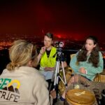
Tenerife’s 2023 wildfire was the most devastating fire in the Canary Islands in the last 40 years and the most severe in Spain in 2023; The fire affected nearly 15,000 hectares, burning 7% of the surface of Tenerife, and causing 80.4 million euros of damage. The forest fire has caused approximately 12 million euros of damage to the agricultural sector, including 2,500-3,500 hives that were destroyed. In addition, it caused more than 12,000 people to have to be evacuated throughout the course of the fire, 364 farms and 246 buildings were affected. Up to 60 protected species may have been impacted by the forest fire, but the true impact on these species is not yet known.
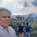
The volcanic eruption on La Palma was preceded by a seismic swarm starting on September 11th, and by September 19th the volcano, later named Tajogaite, started erupting. Over the following weeks and months, the lava flows continued to advance, encroaching over 900 hectares of land and destroying more than 1,000 buildings. The eruption was accompanied by earthquakes with magnitudes up to 5.1 mbLg, occasionally felt across multiple Canary Islands.
Our Day-by-Day Eruption Updates from September 11th 2021 – December 25th 2021 includes:

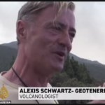
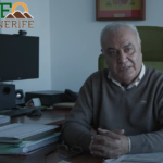
We are often interviewed by local, national, and international news sources for information about volcanic activity, forest fires, and more in the Canary Islands. We are happy to share our knowledge with as many people as possible.
Alongside our resident-focused science, we run the campaigns FFP2 and SamuLaPalma to support those affected by the La Palma 2021 eruption. Furthermore, we make school visits to encourage volcano science in younger Canarian Residents, and also make our internship programmes accessible to students who live in the Canary Islands to ensure our projects benefit the residents of the Canary Islands.
We co-organise the annual VulcanaSymposium with the IEO and also attend other volcanological conferences, VMSG, IAVCEI, and COV12, to discuss our projects and their results with experts in the field of volcano science, in particular Q&As for our LavaBombs documentary. Our VolcanoStories Content Co-ordinator was invited to present at the Royal Holloway University Lyell Geology Day regarding the Tajogaite Eruption timeline project.

GeoTenerife is committed to fostering valuable collaborations with local, national, and international research institutions, to both conduct valuable geoscience research in the Canary Islands
We are always looking to welcome new collaborations, so if you or your company/research institution is interested in collaborating with us, please get in touch with us via enquiries@geotenerife.com
Our Collaborators include:
and many more valued collaborators.


